Visit to the Canyon of the Rio Marañon (July 28th – August 1st 2019)
Prior to attending a biogeography conference in Quito we arranged for some time to visit Peru and cactophile friends there. We also arranged for a short trip to the northern Marañon River canyon – a relatively remote region in northern Peru known for its cacti and other succulents. This trip is described on this page. We also describe a visit to a Zoo and Botanical Garden in Lima that we had never visited – despite having been in Lima many times. The visit was a real eye-opener for us, especially since it was guided by a Garden founder and succulent plant specialist. That visit is described on the page Parque de las Leyendas.
Why visit the canyon of the Rio Marañon?
The lower elevations of the Rio Marañon are well-known to cactus aficionados as a region hosting many species. We were familiar with parts of the region from previous trips in 1997 and 2006, but had never descended from Cajamarca to the bottom of the canyon at Balsas and wanted to see the transition of vegetation. The canyon is well-marked as a minimum in daytime cloudiness from satellite imagery averages and it would be interesting to see how this corresponded to the observed vegetation.
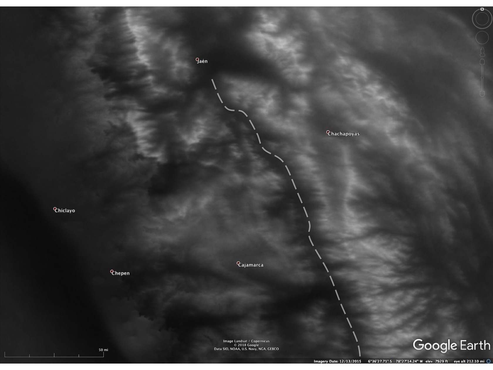
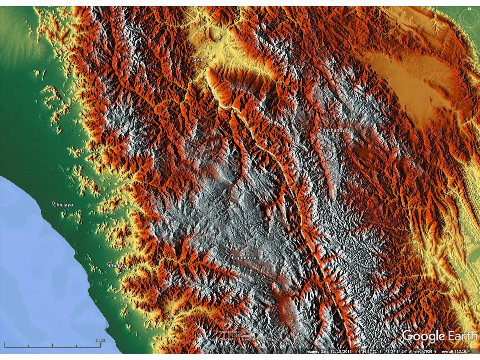
Below are Google Earth depictions of the relief, cloudiness and land surface. They show the same areas and the Rio Marañon canyon is depicted by the dashed curve. It is often easier to make “toggeling” comparisons from a Powerpoint, which can be downloaded here.
01 Basic geography of the travel area to the lower Rio Marañon canyon. Click on individual images for explanations.
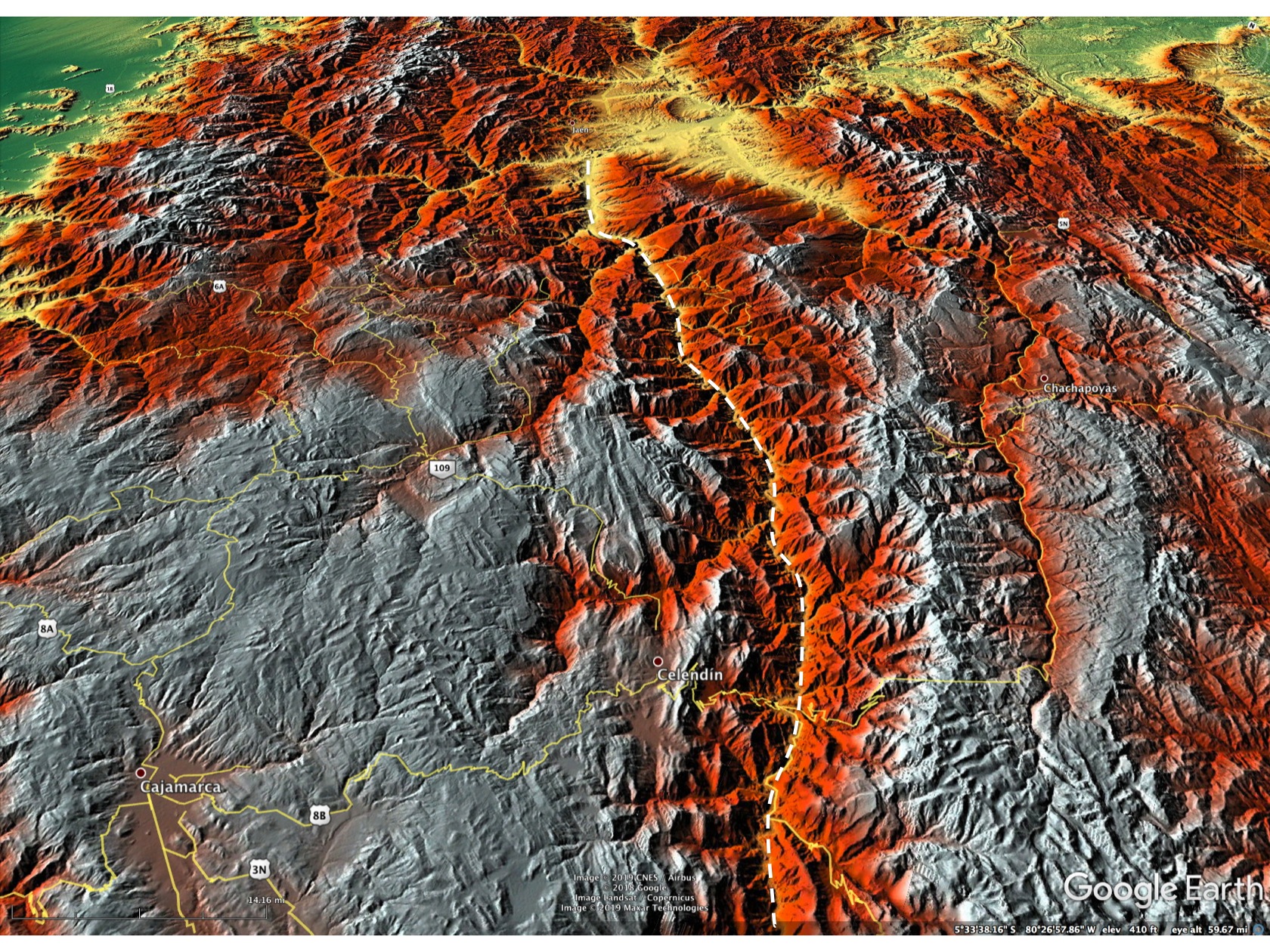
A oblique angle depiction of the Rio Marañon canyon and some of the key towns and places along the route are shown below. The figure captions explain the individual images.
02 Oblique view of the travel area. Click on the images for explanations.
Day 1
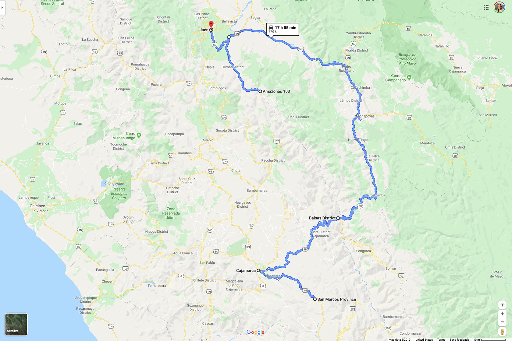
Manolo Fernández, the head of SUMPA, an environmental consulting company in Lima (but also the current Vice-President of the Peruvian Cactus and Succulent Society) organized our request for a short trip to the Rio Marañon region. He was accompanied by Maria Isabel Rodriguez, a certified drone-operator working for SUMPA. We flew to Cajamarca on July 28 (2019) rather than drive, saving a very long (~870km, ~540 mi) day’s drive from Lima. Our planned route would involve a 315 mile (503 km) drive from Cajamarca to Jaén.
03 Our route from Cajamarca to Jaén. The small route southeast from Cajamarca was on our first half-day to look for Matucana.
Arriving after mid-day, we met a local couple, Nelson Cieza and his wife, who were teachers in Cajamarca and also very interested in cactus of the region and with extensive experience exploring locally. They guided us to locations southeast of Cajamarca to see two Matucana species that were flowering.
In general, much of the highlands of Peru have been inhabited for many centuries and agriculture and pastoralism have greatly affected the landscape. However, in areas too rocky or steep for agriculture, “natural-ish” landscapes remain. The areas we explored were surrounded by disturbed landscapes, yet native species were still present.
Though there were only a few hours available to us, we the two interesting localities that we explored had very different Matucana species that were flowering. The first site was focused on seeing a red-flowered Matucana, though a host of lithophytic bromeliads were also present, as well as several other cactus and other succulents.
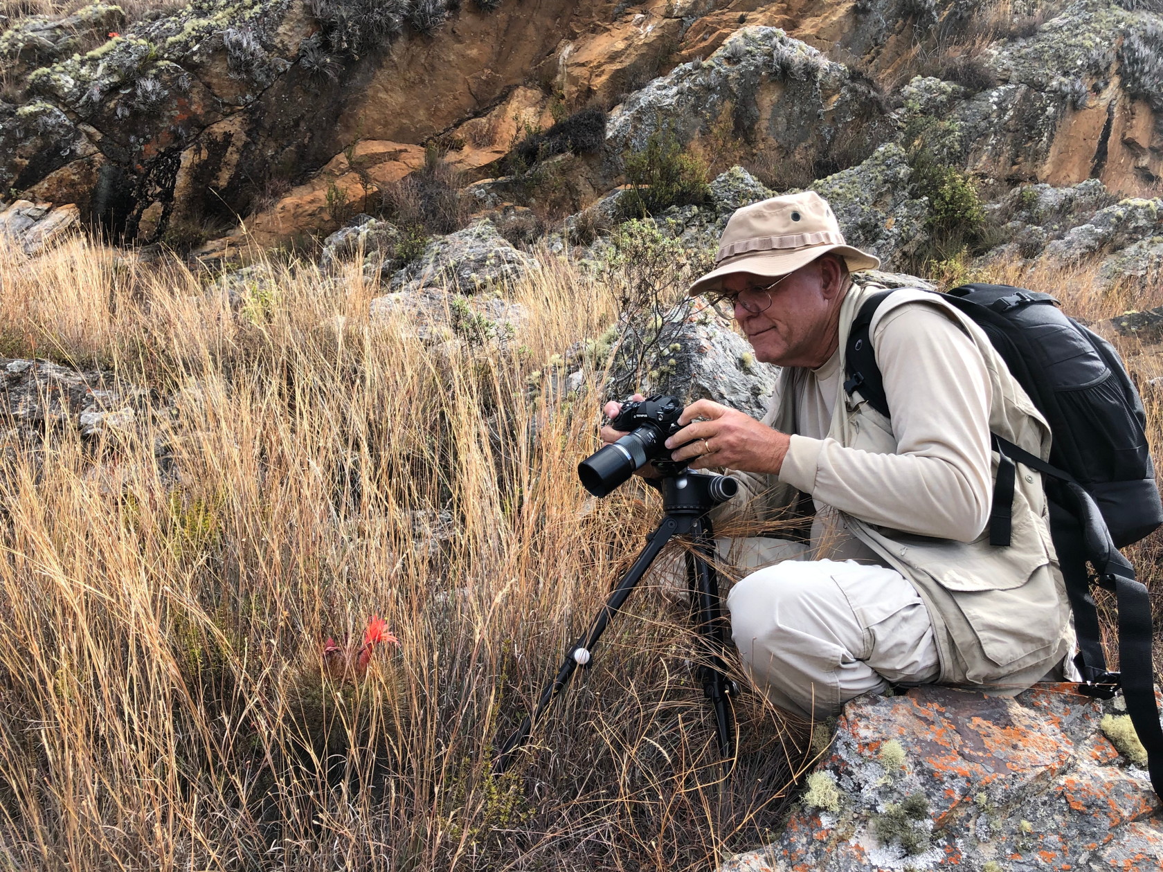
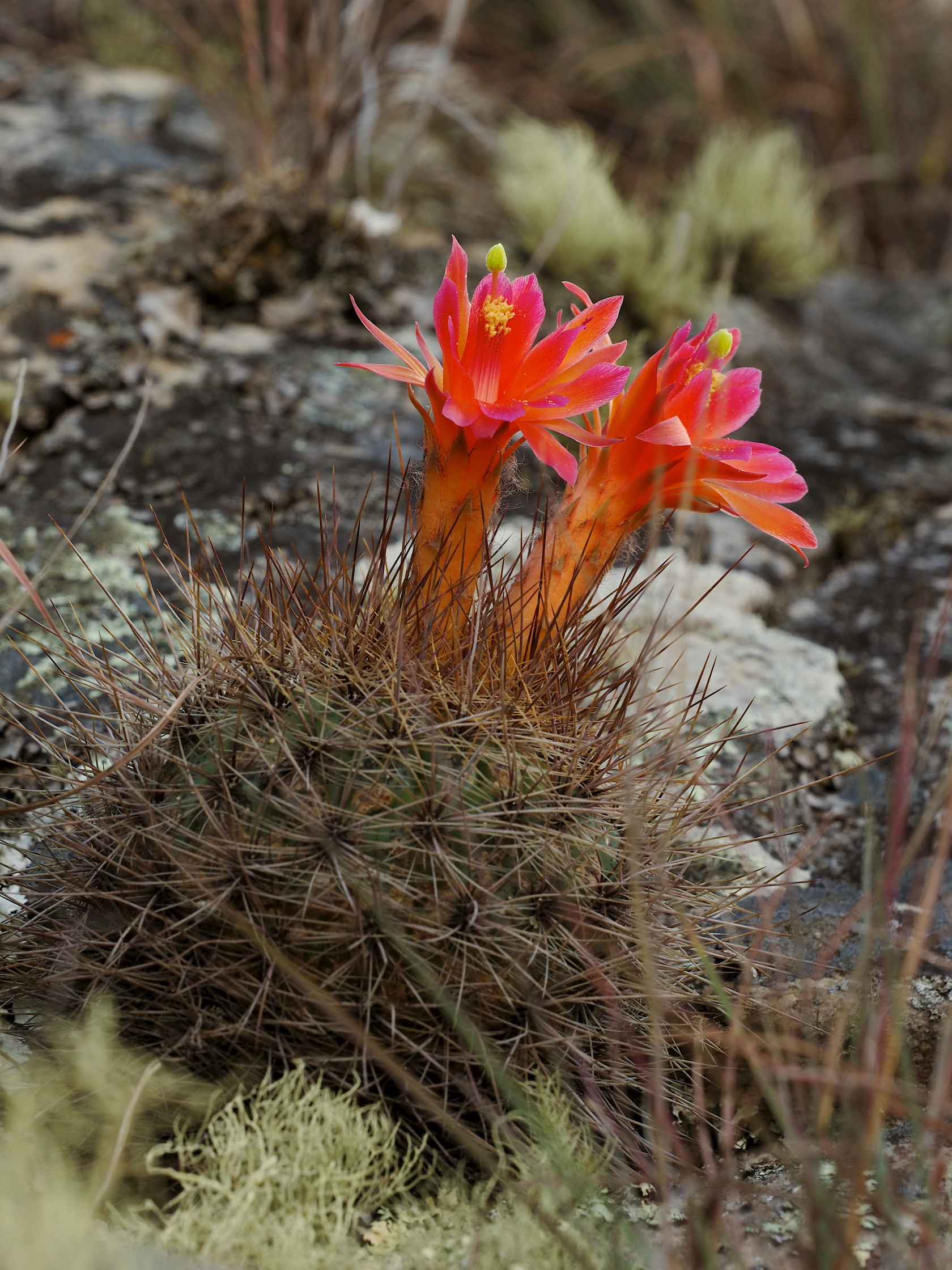
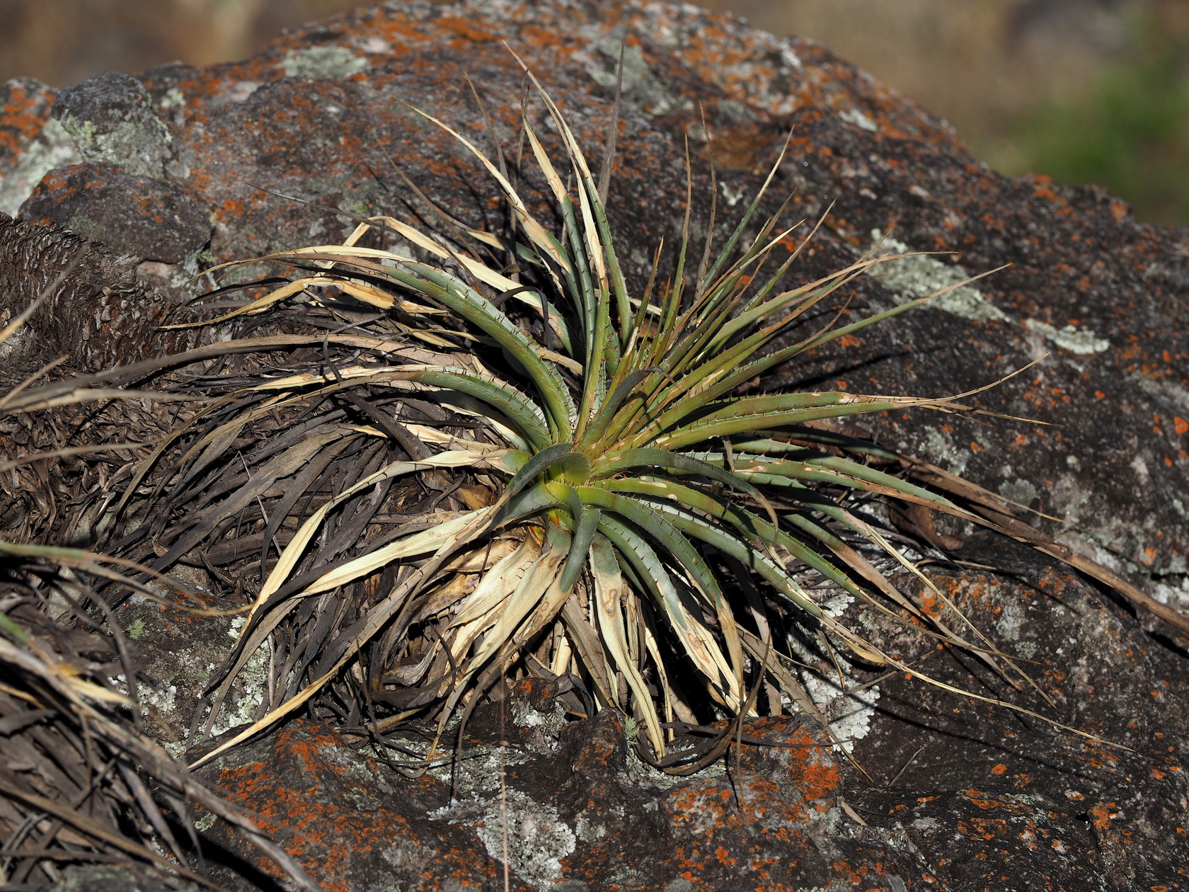
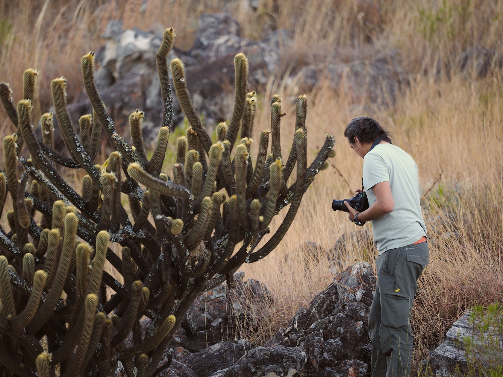
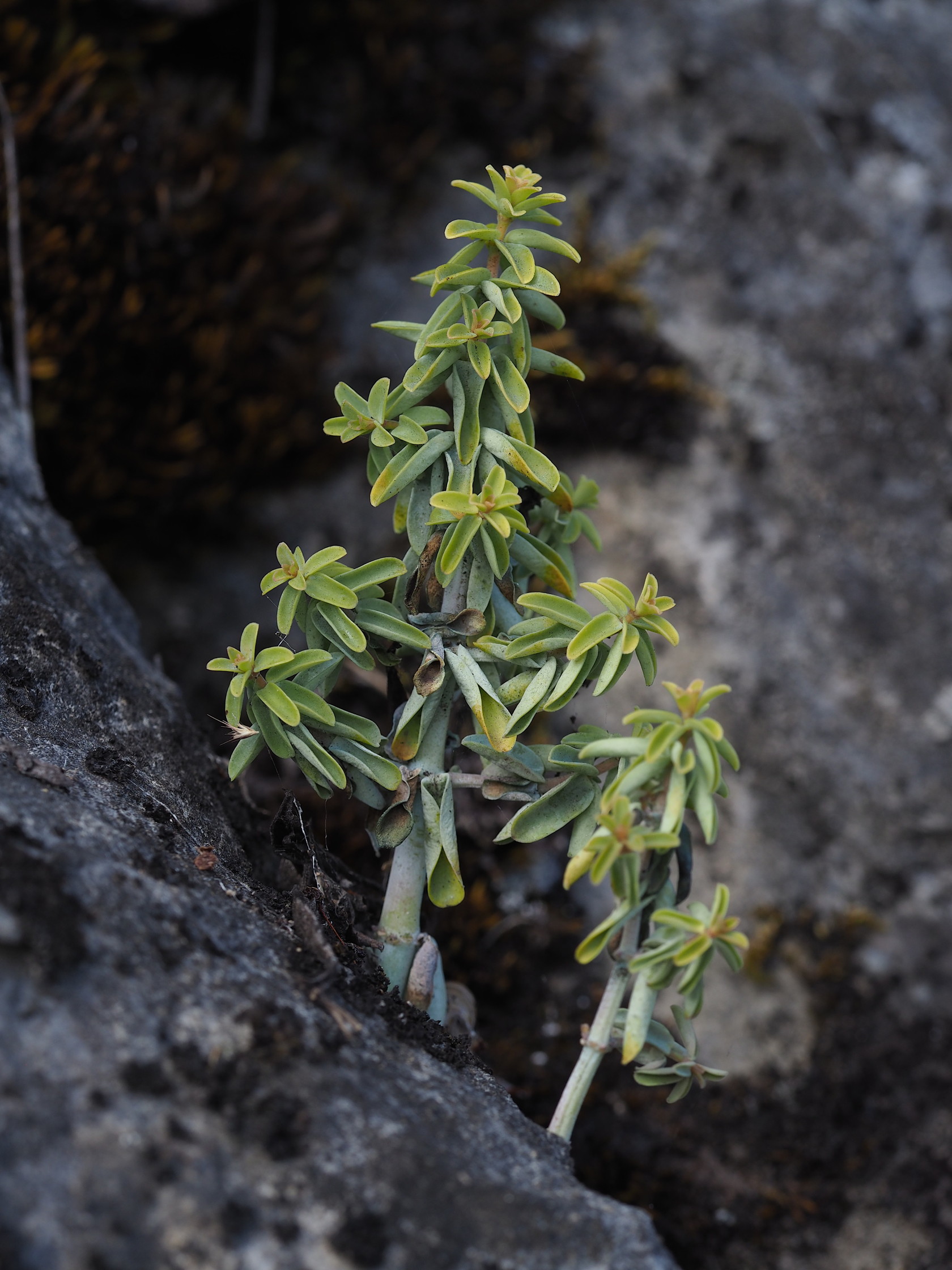
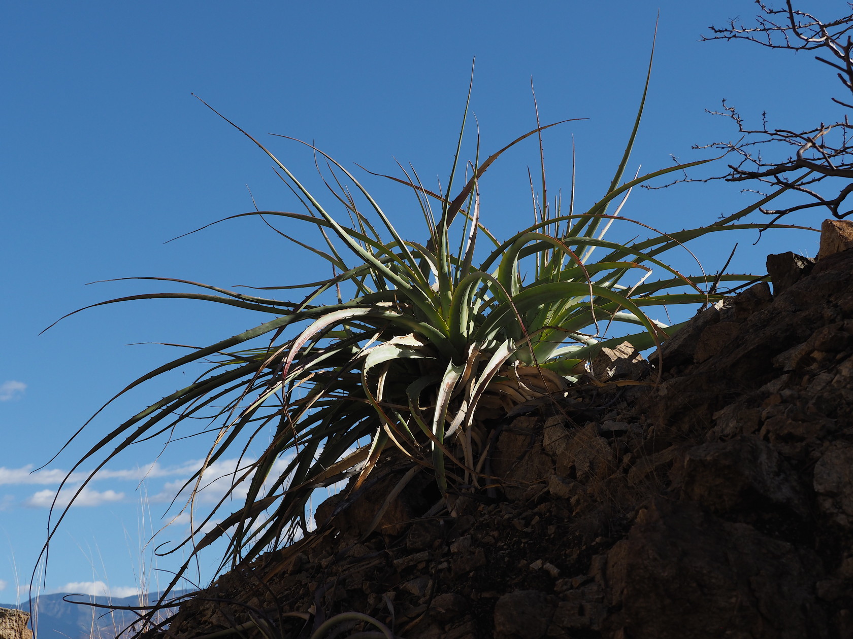
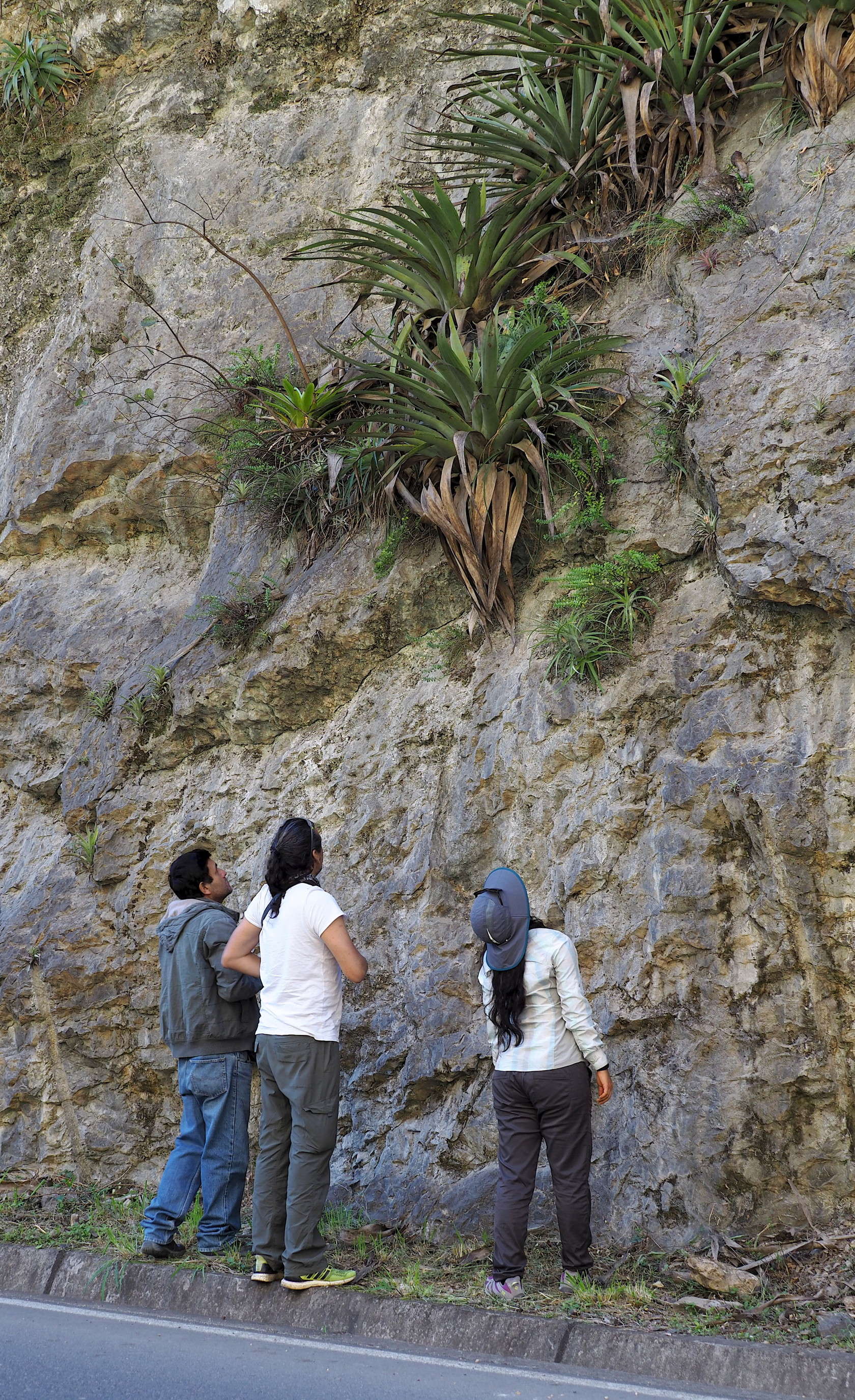
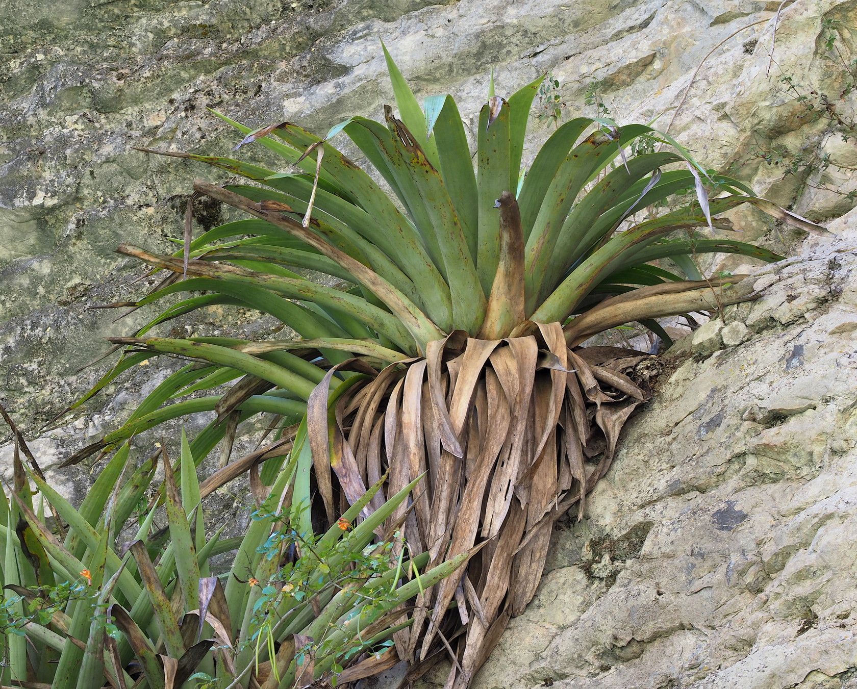
04 Our first stop, with relatively natural vegetation in the foreground and agricultural fields and Eucalyptus in the background. 05 Looking the opposite direction to the previous image, this is the rock outcrop that we investigated, covered with Tillandsia and Matucana.06 iphone panorama image showing both the rock face on right and the agricultural fields on left. The point of this image is to emphasize that finding interesting/native species requires looking for undisturbed habitat in a sea of human-induced disturbance that has probably existed for millennia in this area. Click on image for a larger version.07 A relatively succulent Matucana aurantiaca08 Photographing a flowering Matucana aurantiaca. Using a tripod is best for composition, but there was not much time on our trip for such photography. Also, relatively few subjects were small (like Peperomias) that required special photography techniques like image-stacking (that require a tripod).09 A flowering Matucana aurantiaca.10 Maria Isabel and the Cajamarca teacher Nelson Cieza exploring the Tillandsia macbrideana var. longifolia festooned rock slope on the road to San Marcos. Elevation is about 9800 ft (~3000m).11 A closer view of the Tillandsia macbrideana var. longifolia.12 A still closer view of the Tillandsia macbrideana var. longifolia with flowers (barely visible). Rock appears to be sandstone.
Our second stop, just outside the town of San Marcos, was similarly disturbed as the first stop. However, like the first stop, a short walk led to a relatively natural hillside with cacti and other mostly native vegetation. A different Matucana species was here, as was a Lasiocereus rupicola – that we never saw again during the following days.
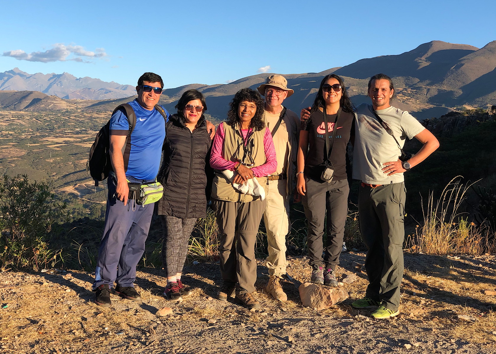
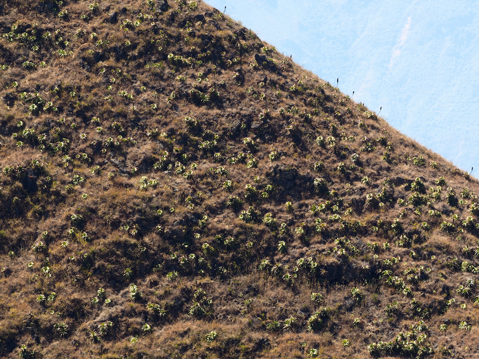
14 Landscape of the second stop, just outside of San Marcos. Elevation is about 8400 ft (~2560m). A Matucana aureiflora with flower bud is in the foreground, near center. They were difficult to see amongst the grasses.15 Can you guess what this is a silhouette of? A Puya species? Probably Deuterocohnia longipetala.16 Matucana aureiflora with a yellowish flower. Plants were buried in the grass. The actual color of most flowers was more yellowish.17 Another flowering Matucana aureiflora (iphone photo)18 A Deuterocohnia longipetala, the same species as in the silhouette (15) above. A member of the Pitcairnioideae subfamily of the Bromeliaceae.19 Manolo inspecting a Lasiocereus rupicola just outside of San Marcos – about 8300 ft.20 Lasiocereus rupicola near San Marcos (about 8300 ft elevation).21 Group photo of the first day participants… taken by a member of a group of motorcyclists at the same lookout.
Day 2
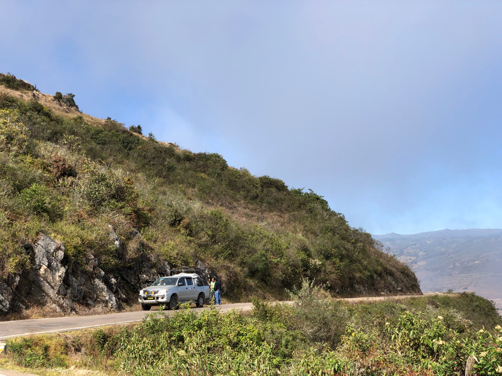
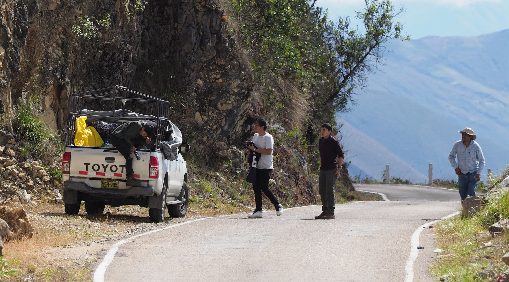
Early the next morning we met our driver for the Marañon portion of the trip, together with his two sons and a cousin. He drove us in his Toyota Hilux pickup for four days, arriving in Jaen – from where we flew back to Lima. The route is shown in Fig. 1.
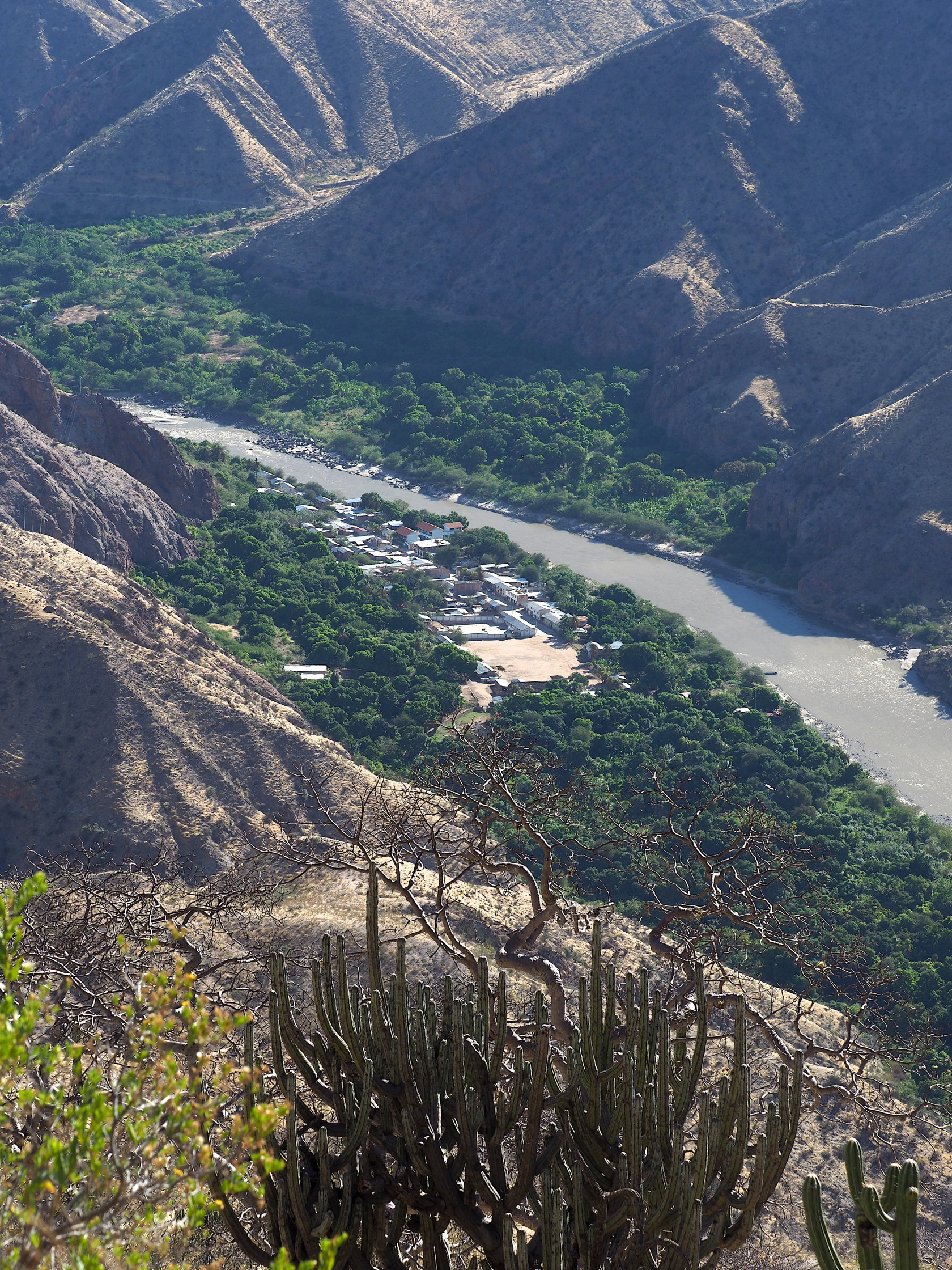
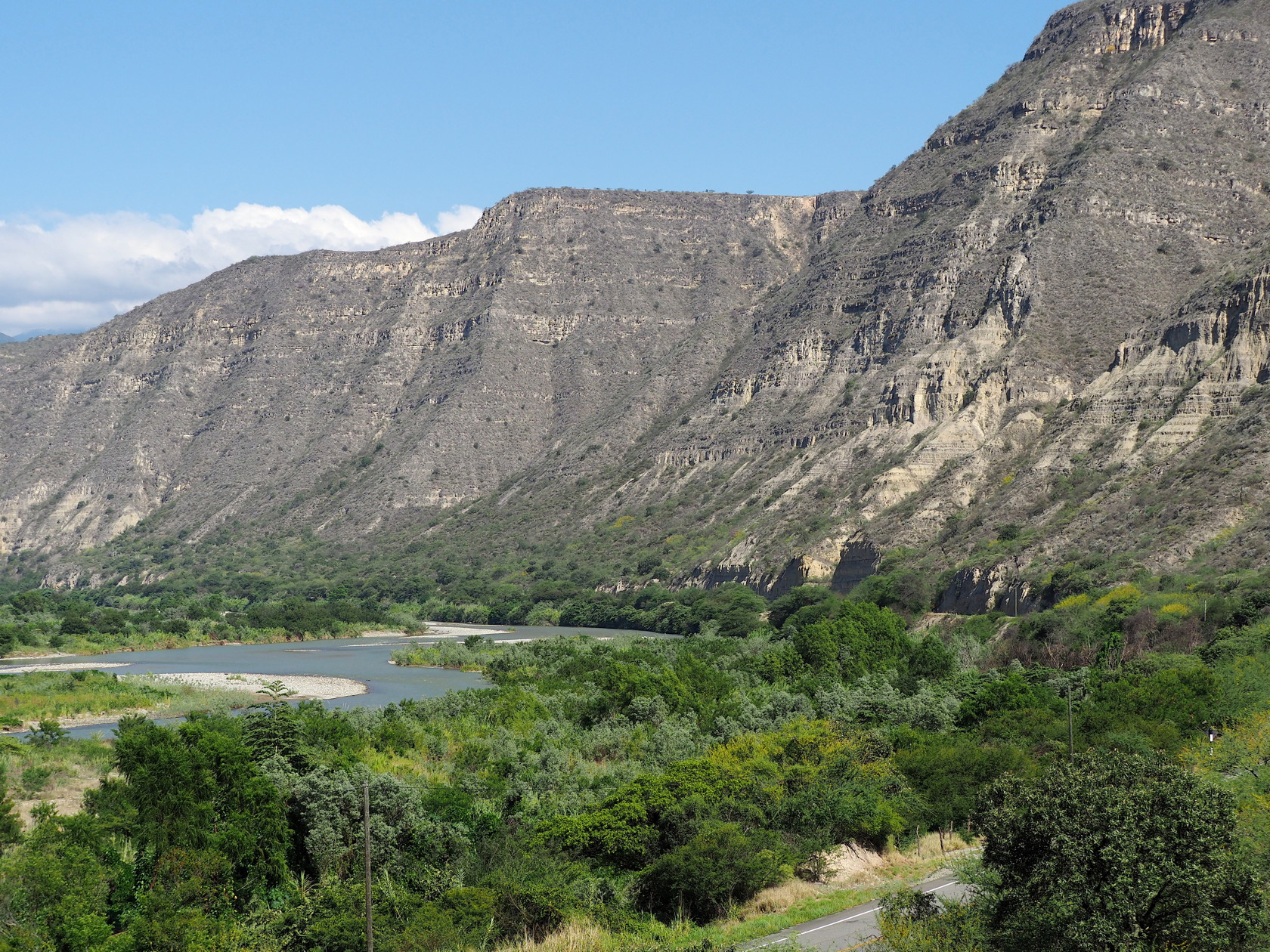
Our route the first day was long – from Cajamarca, past the smaller town of Celendin where we had breakfast, descending to the smaller town of Balsas – where we had lunch. We arrived at the small town of Leimebamba after dark. While the total distance does not seem onerous (246 km 153 mi), we descended from Cajamarca (8950 ft) to Balsas (2800 ft) then climbed to nearly 12000 ft before descending to 7200 ft at Leimebamba!
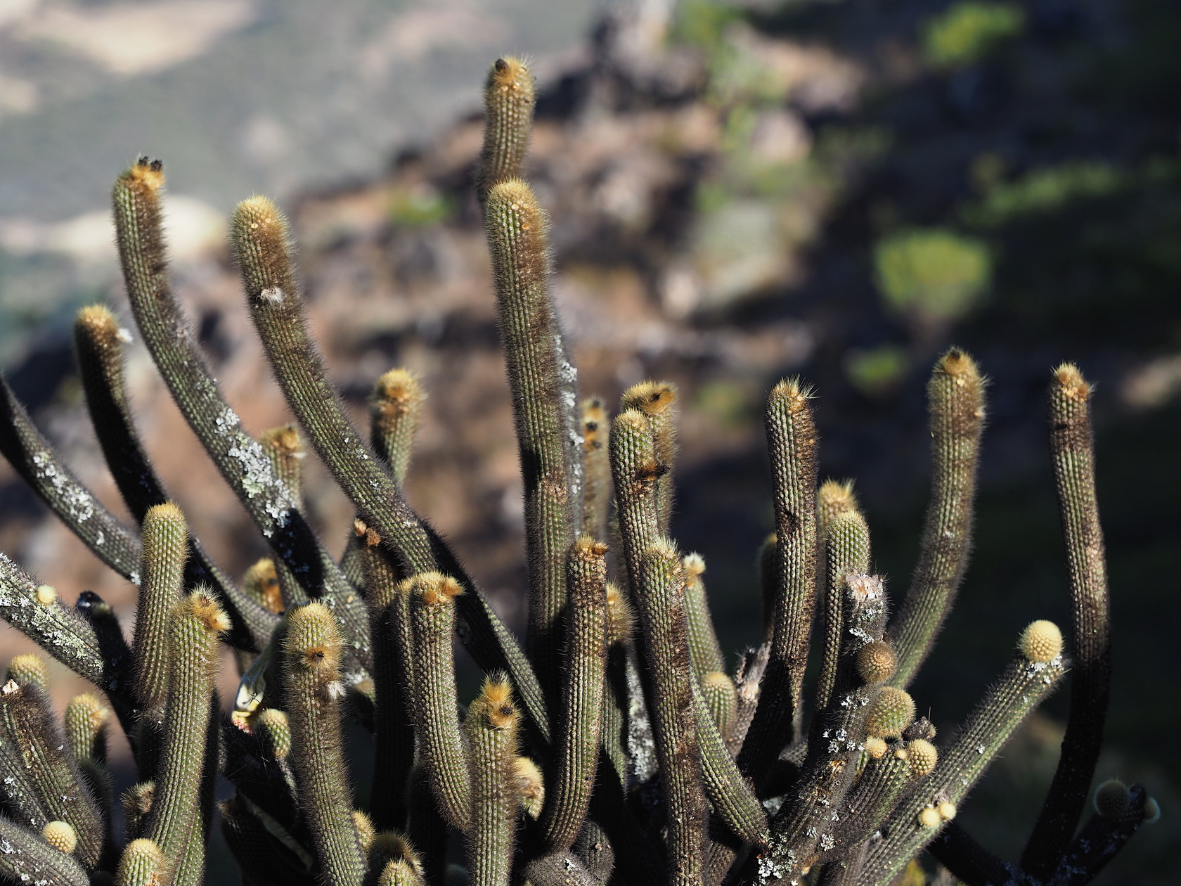
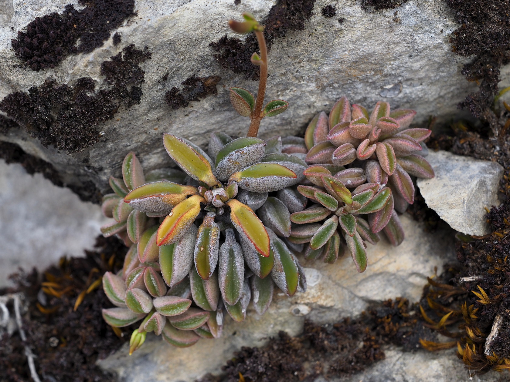
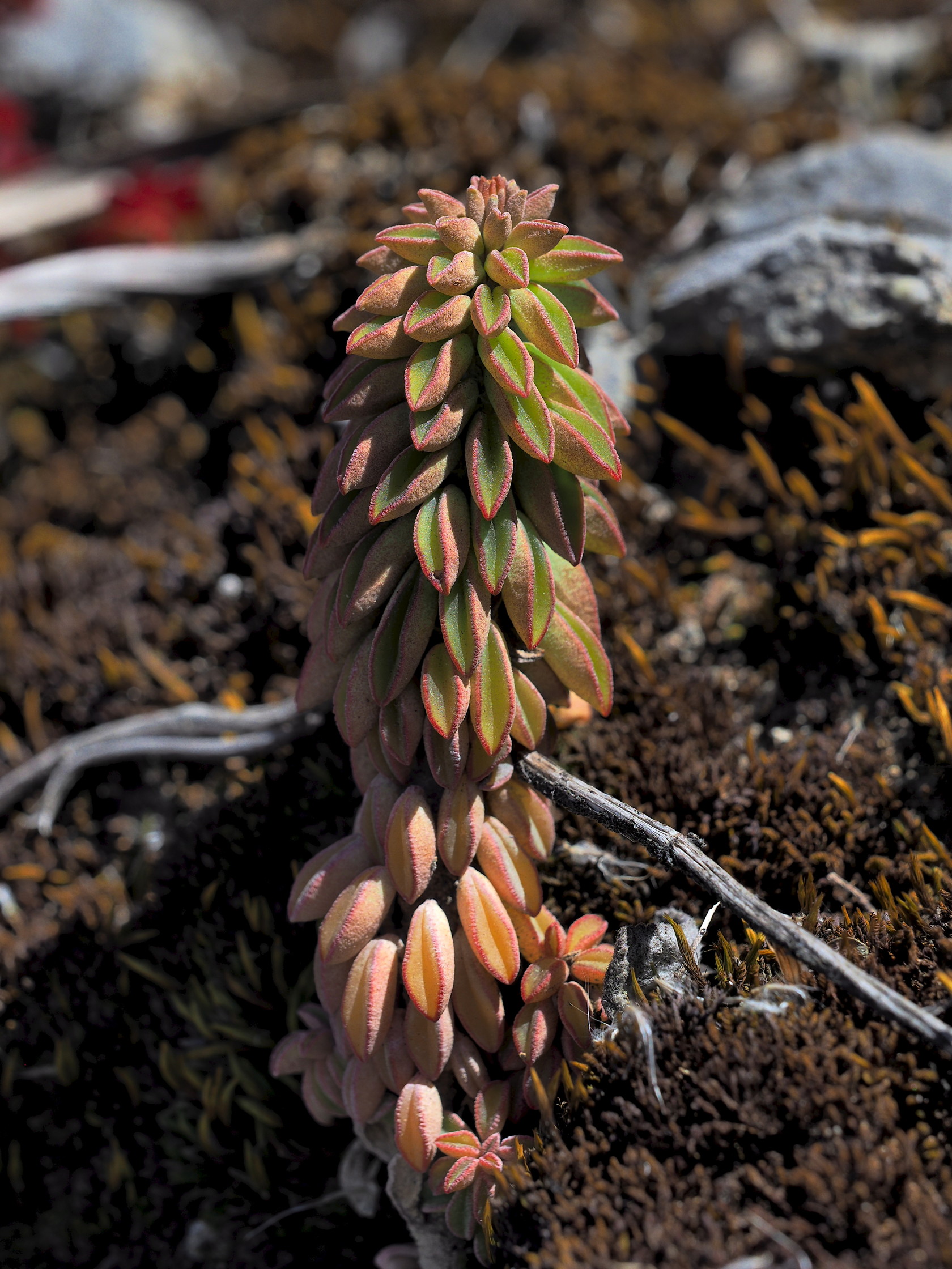
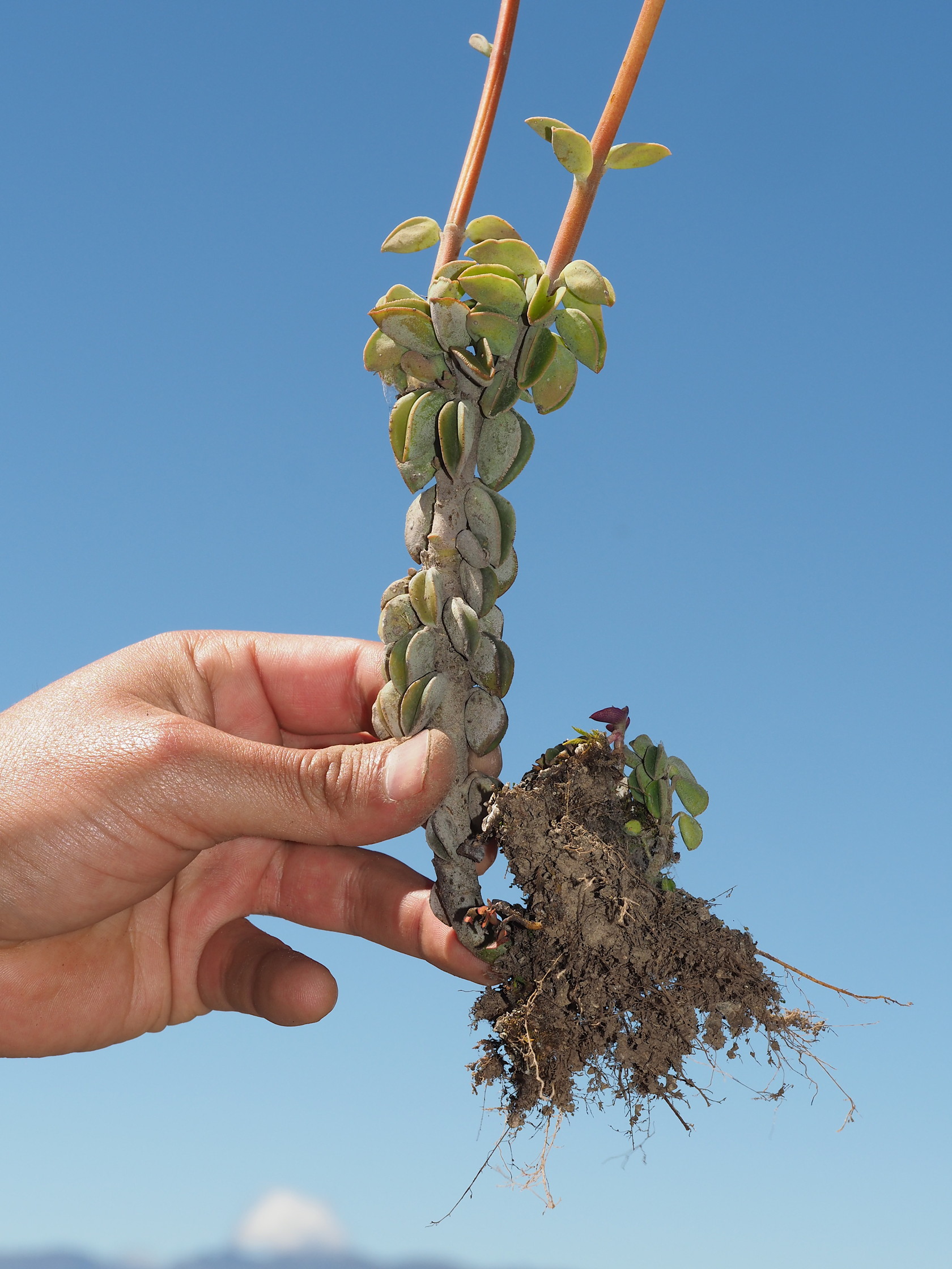
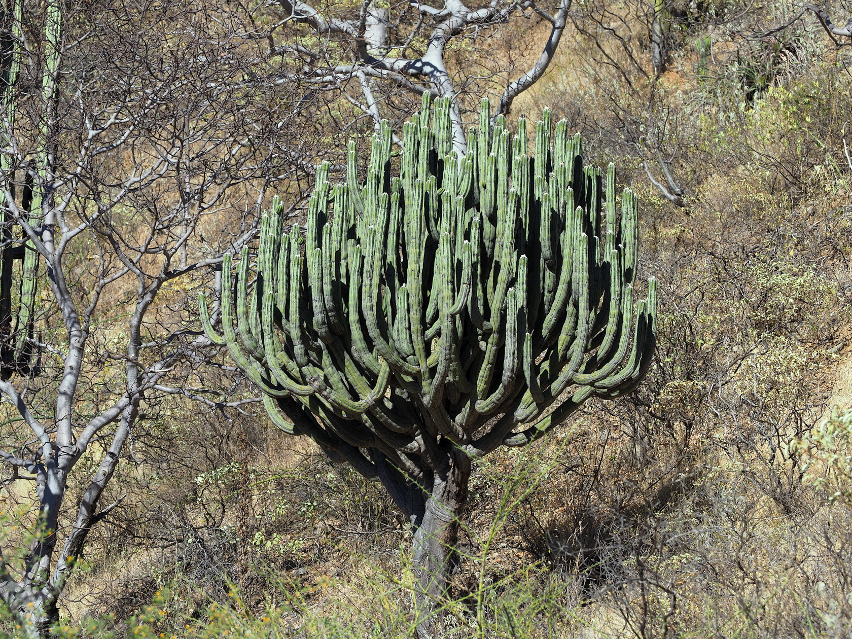
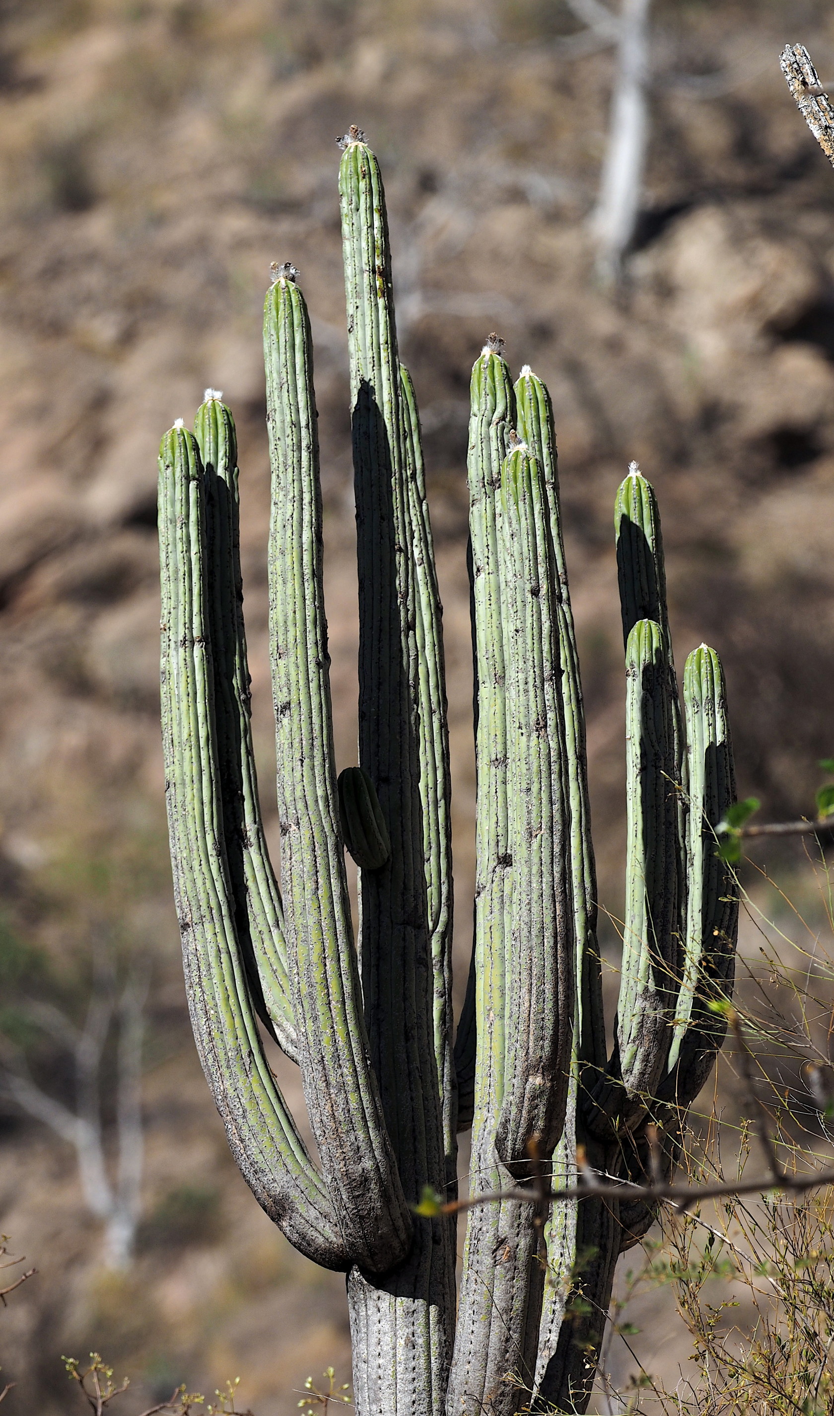
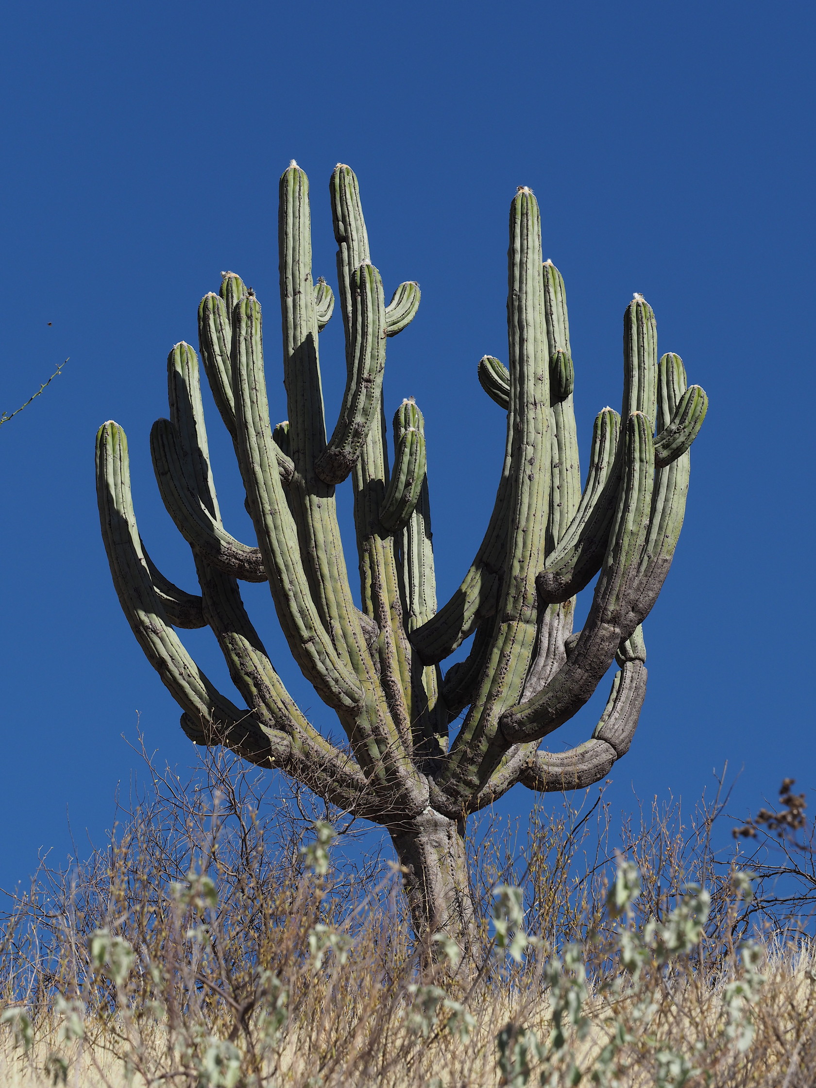
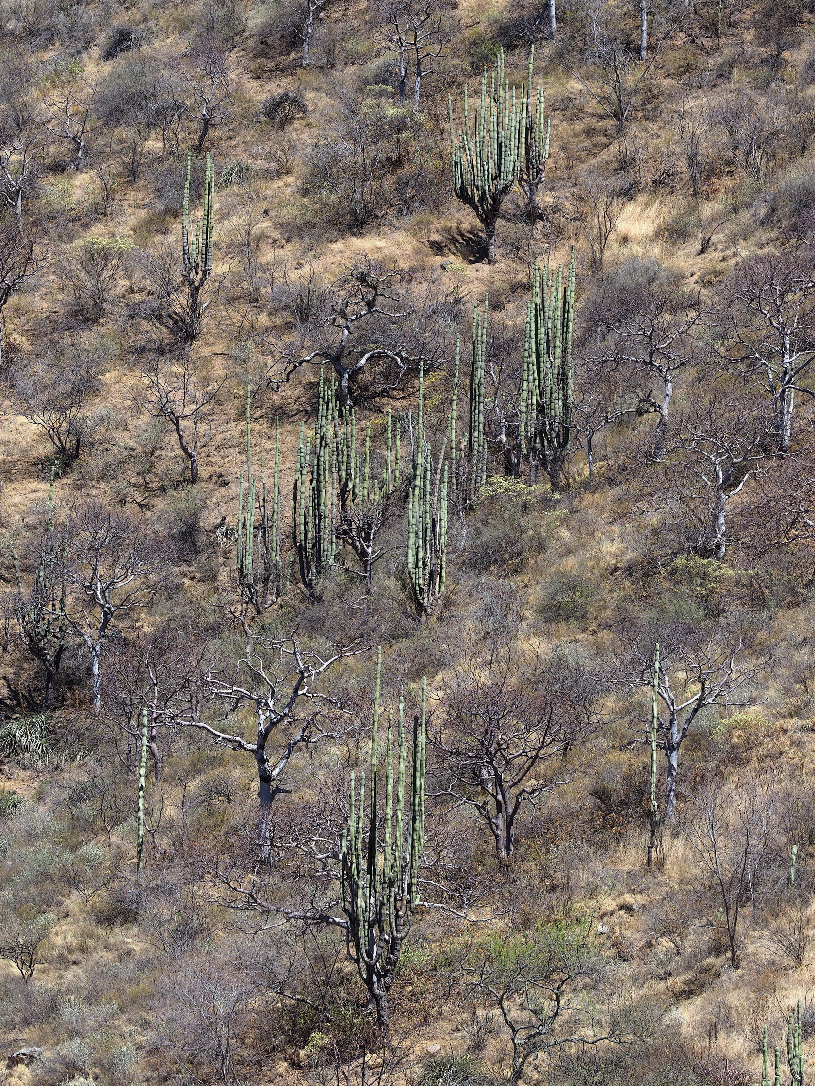
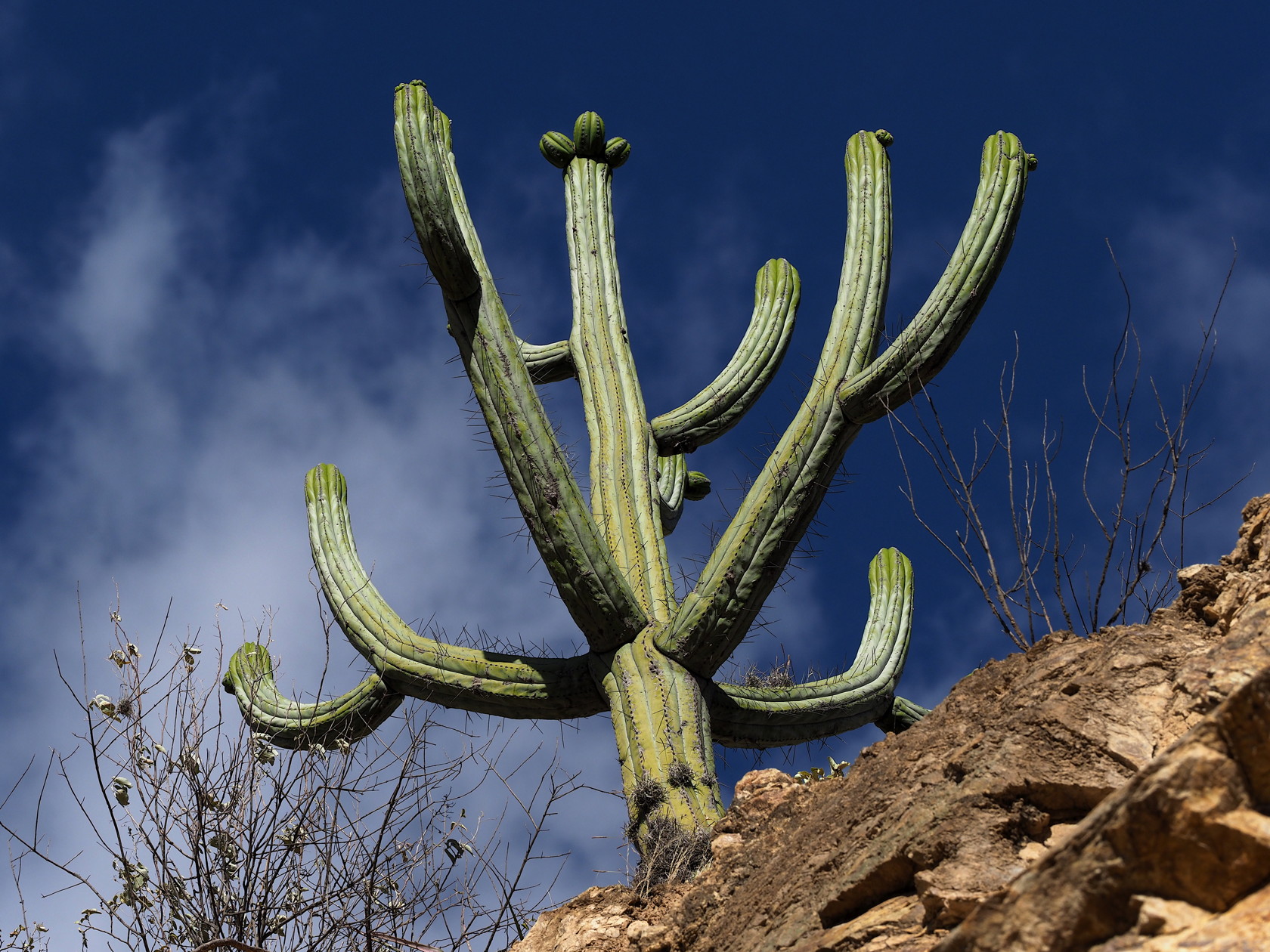
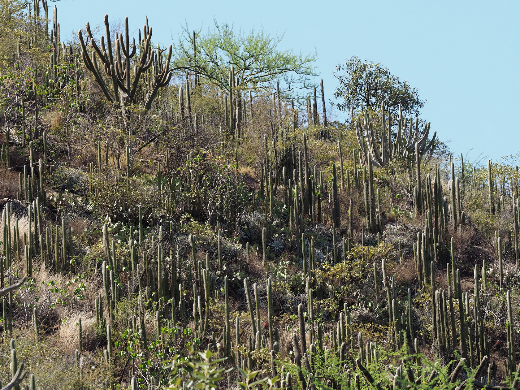
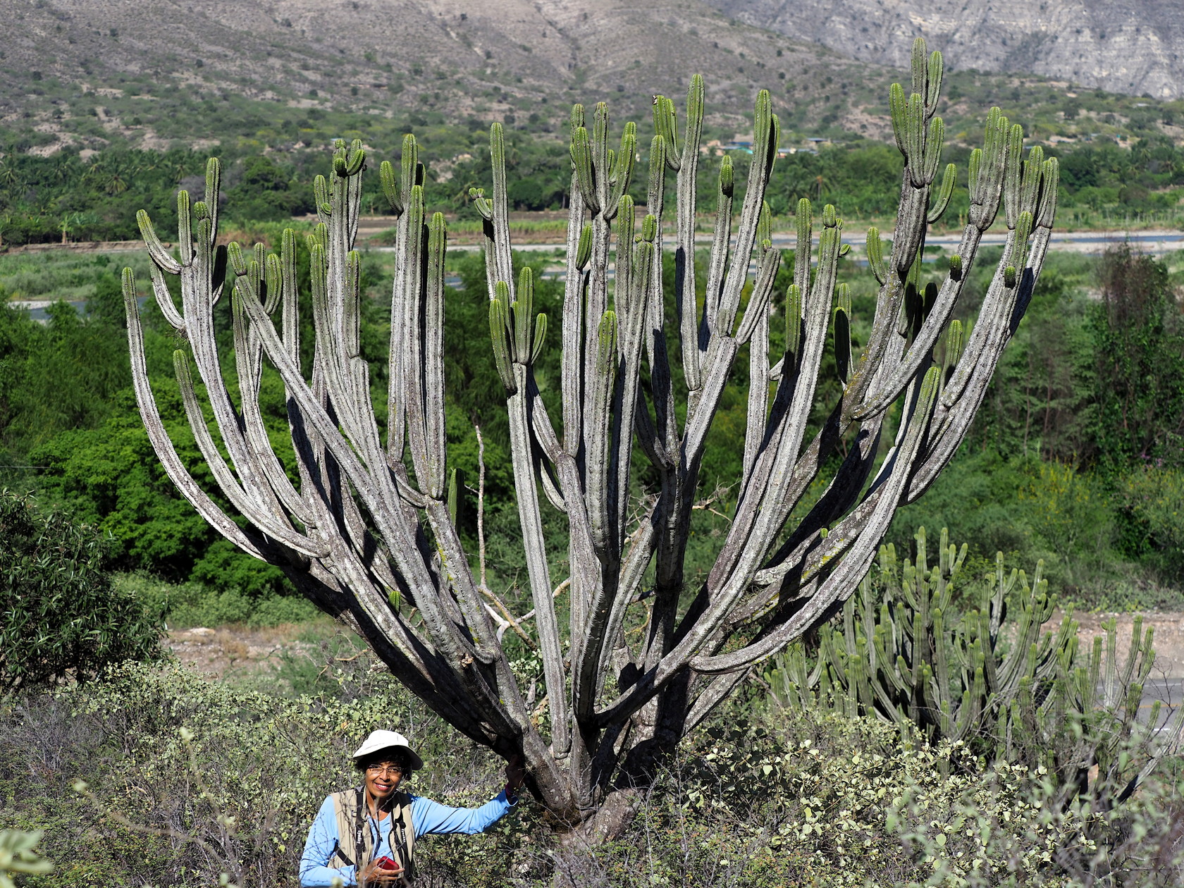
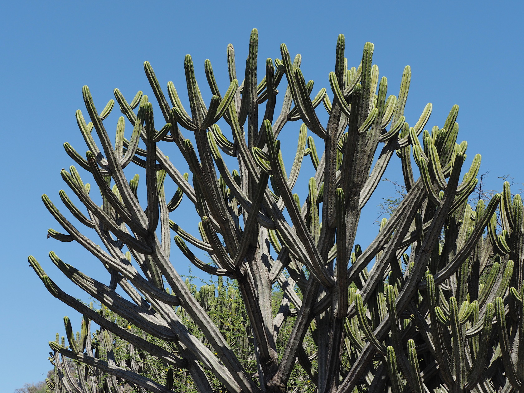
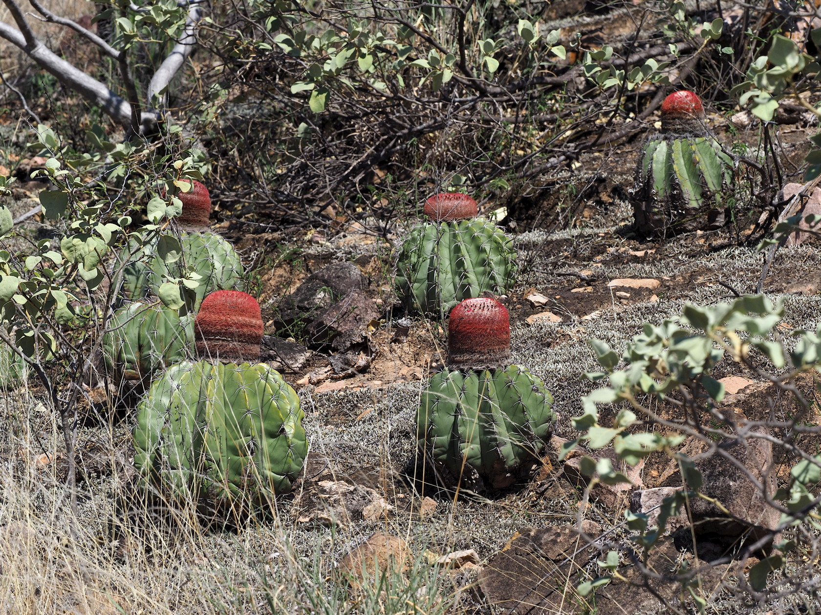
22 The town of Celendin (about 8300 ft elevation), the last town before reaching the much smaller town of Balsas on the Rio Marañon – at 2800 ft. Note the typical Andean landscape of small agricultural plots conforming to the landscape. Almost all trees evident here are introduced Eucalyptus. Interestingly, neither our driver nor his sons and cousin knew that Eucalyptus were from Australia and not from Peru. Also, none of them had ever visited Lima.23 Photo of a typical “side-of-the-road” stop just outside of Celendin, elevation about 10,000 ft (approximately 3000m). Nothing of obvious interest in this view… until you get closer.24 Example of plants evident along side of the road outside Celendin. This is Peperomiaglauca.25 Closer view of Peperomiacymbifolia var. goodspeedii.26 Another plant of Peperomiacymbifolia var. goodspeedii.27 Some Peperomia specimens were required for identification later in Lima.28 Farther down the road, at another stop we found a few Echeveriaeurychlamys plants, some with flowers. Most were difficult to access high on the road cuts.29 Reaching many of the photographic subjects was difficult – here on a steep road-cut.30 Typical stop during descent into the Rio Marañon canyon. Here is the driver, Marco Huaccha (right), his two sons and a cousin – who were on school break.31 Puyas on a hillside.32 A cluster of Deuterocohnia longipetala.33 A large Espostoa mirabilis.34 A closer view of the cephalia of an Espostoa mirabilis. Flowers arise from these.35 At the lower reaches of the canyon there were nice views of cacti-clad hillsides, here including Armatocereus, Browningia and Espostoa. The prominent trees were Eriotheca (probably E. peruvianus)36 A Deuterocohnia longipetala.37 More Puya – you can see I like them.38 A cluster of Deuterocohnia longipetala on a road-cut.39 A small Deuterocohnia longipetala species.40 Dry forest scene, with a species of Eriotheca and Armatocereus (right). Behind and to the left of the Eriotheca are Browningia and Espostoa.41 There are native species of Bougainvillea in Peru. This is Bougainvillea peruviana.42 A closer view of the native Bougainvillea in flower (the prominent pink are the bracts, the small flowers are enclosed by the bracts).43 Closer view of a young cephalium on an Espostoa mirabilis.44 Looking back at the town of Balsas as we begin to climb out of the Rio Marañon canyon.45 Armatocereus balsasensis above the town of Balsas.46 A large Armatocereus showing periodically “pinches” along the stems.47 A large Browningia pilleifera with many branches.48 Closer view of Browningia pilleifera49 A Peperomia trollii with a very condensed rosette.50 A view looking up at a Browningia pilleifera – a typical photographic problem when access up the slope is difficult.51 A hillside with mature Armatocereus. Note the dry forest trees (genus Eriotheca) that are leafless at this time of year (dry season).52 Inflorescence from a Peperomia cymbifolia var. goodspeedii.53 A Melocactus bellavistensis on a dry rocky slope. This Melocactus has a relatively short cephalium; cephalia of this species can get very long.54 A sparsely-branched Browningia pilleifera – again looking up from the road.55 This shows both the Armatocereus and Browningia pilleifera together. The Armatocereus are the ones with “pinched” stems.
Day 3
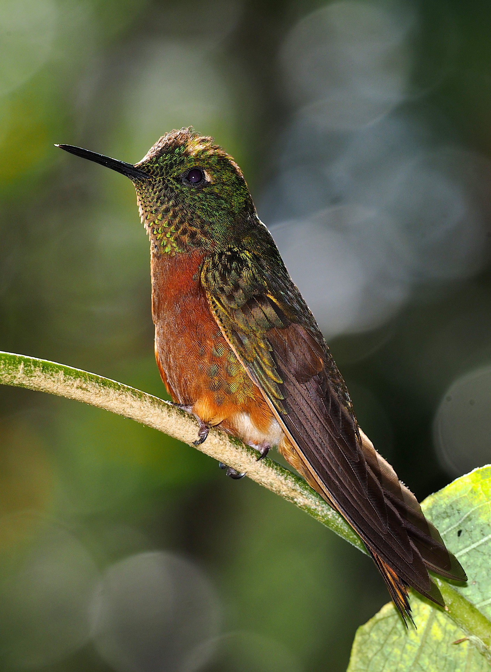
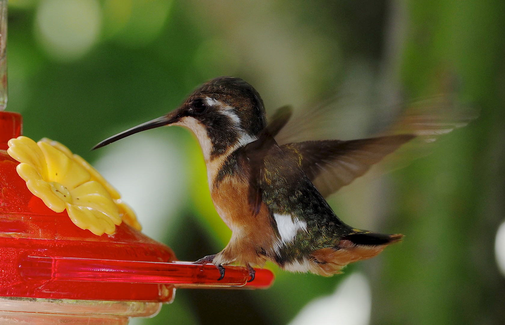
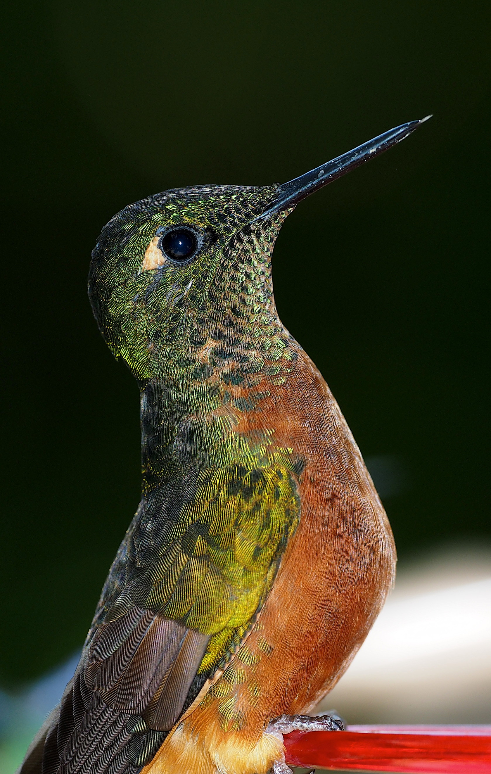
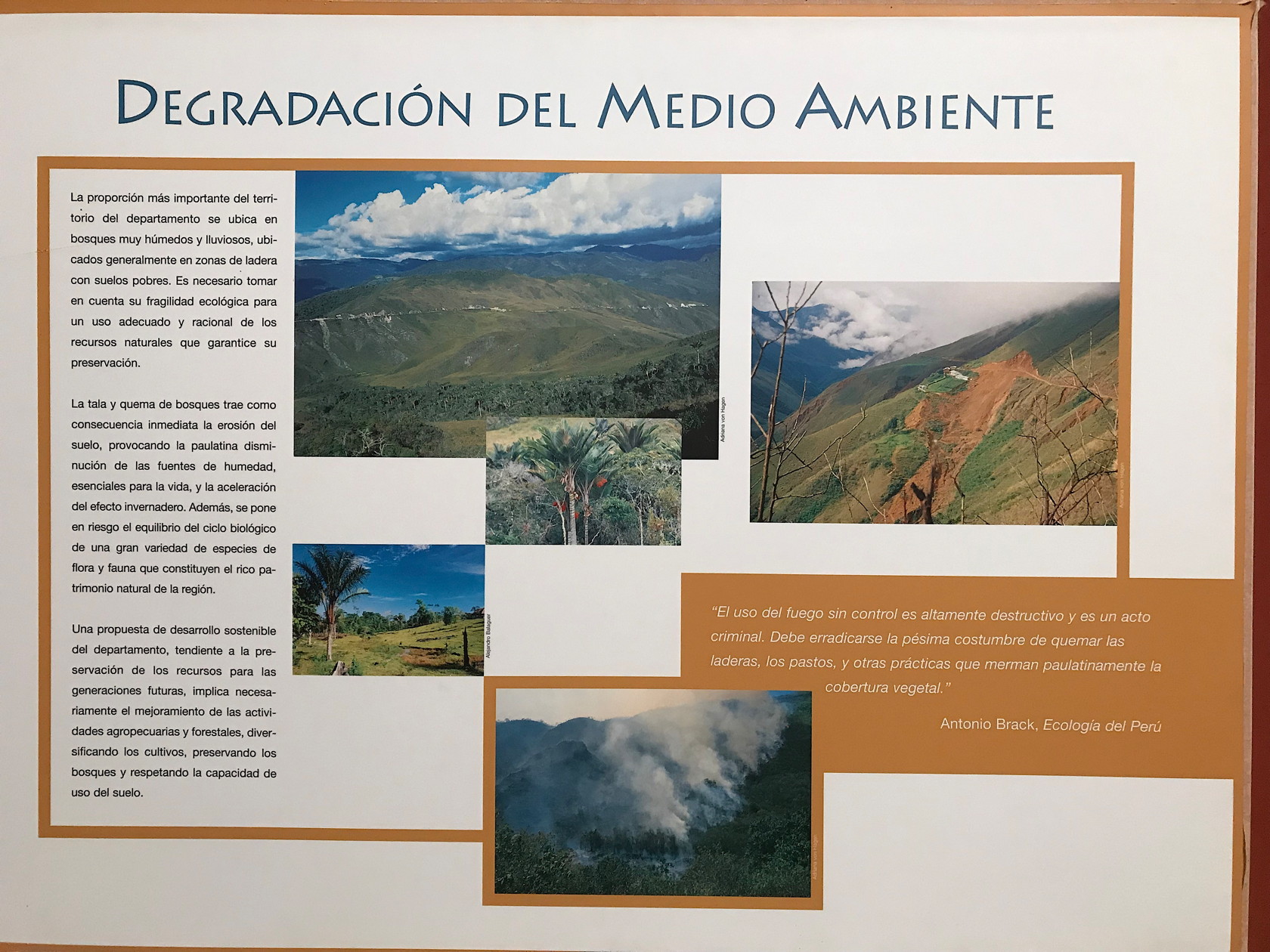
The route from Leimebamba to Chachapoyas was not particularly long, but we spent considerable time at the Museo de Leimebamba (Mummy Museum) and the small restaurant across the street that had hummingbird feeders and was a site well-known to birders. This was our first real introduction to Andean hummingbirds at feeders and we were amazed at the variety and different characteristics of some of the birds.
56 A Hummingbird (Chestnut-Breasted Coronet, Boissonneaua matthewsii) at the Kente Tambo restaurant across from the Museo de Leimebamba (Mummy Museum)57 A very small Hummingbird (White-Bellied Woodstar, Chaetocercus mulsant) at the feeder; this hummingbird made the sound of a bee when flying because of the very fast wingbeats. However, it actually flies slowly, much like a bumblebee.58 A closer flash photo (a crop of the original) of the most common Hummingbird at the restaurant feeders across from the Leymebamba Mummy Museum. It is a Chestnut-Breasted Coronet, Boissonneaua matthewsii.59 Some of the mummies in the Museo de Leimebamba.60 Example of the excellent plaques in the Museo de Leimebamba. This one talks about the Degradation of the Natural Environment by humans.61 A plaque showing the ecoegions of Peru and the relief.
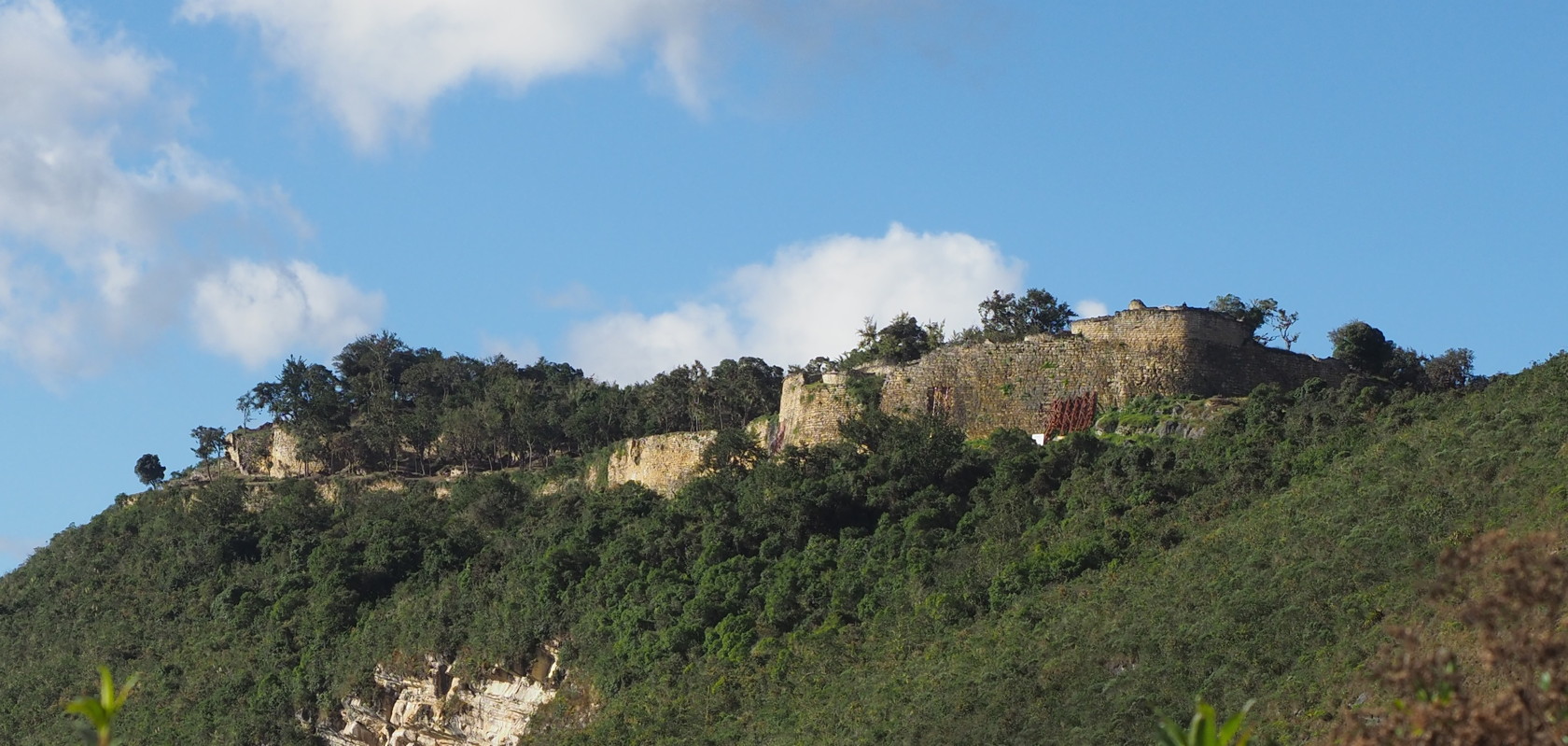
Before arriving at Chachapoyas we detoured to visit the pre-Inca fortress of Kuelap. Unfortunately, two factors conspired against us. First we arrived late in the day and the fortress was to close shortly after we arrived. Then it was a national holiday and the crowds were much, much larger than on weekdays or non-holidays!
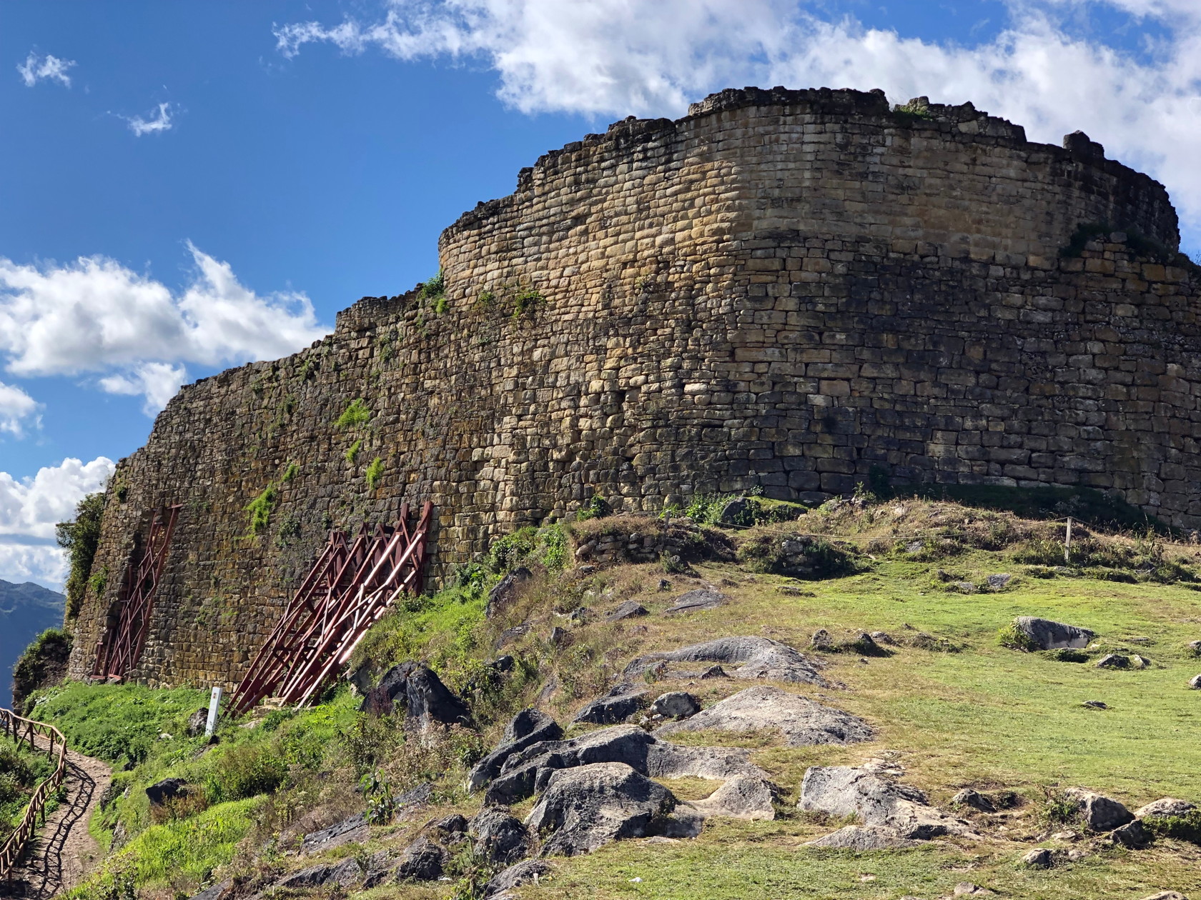
62 The fortress of Kuelap in the distance. A trail leads to the fortress; altitude is about 3000m above sea level.63 The main wall of Kuelap. It is being restored, hence the supports on the left. Above there are many round housing units that are partly restored (we didn’t get closer than this, though others in our group did). This is at about 10,000 ft elevation.
Though some in our group did manage to walk the fortress circuit Rosario and I only arrived to the outer walls, and we then decided to spend more time looking at the plants on the trail. The advertised closing time was, it turns out, not strictly enforced and we ended up waiting a half hour in line for the gondola ride down. The gondola was newly constructed and spanned a large dry canyon with lots of Puya clusters of some sort. The Kuelap fortress can also be reached by driving a long dirt road, but the new gondola saves the drive.
In summary, if at all possible, plan your visit to Kuelap for a weekday and early in the day. However, from a botanical perspective, the trip to Kuelap was not really worthwhile. Of course most tourists, and nearly all of the Peruvian tourists, would have a very different opinion of the overall experience! The gondola ride up and down was nice and relatively long, and certainly novel to the Peruvians with us.
Day 4
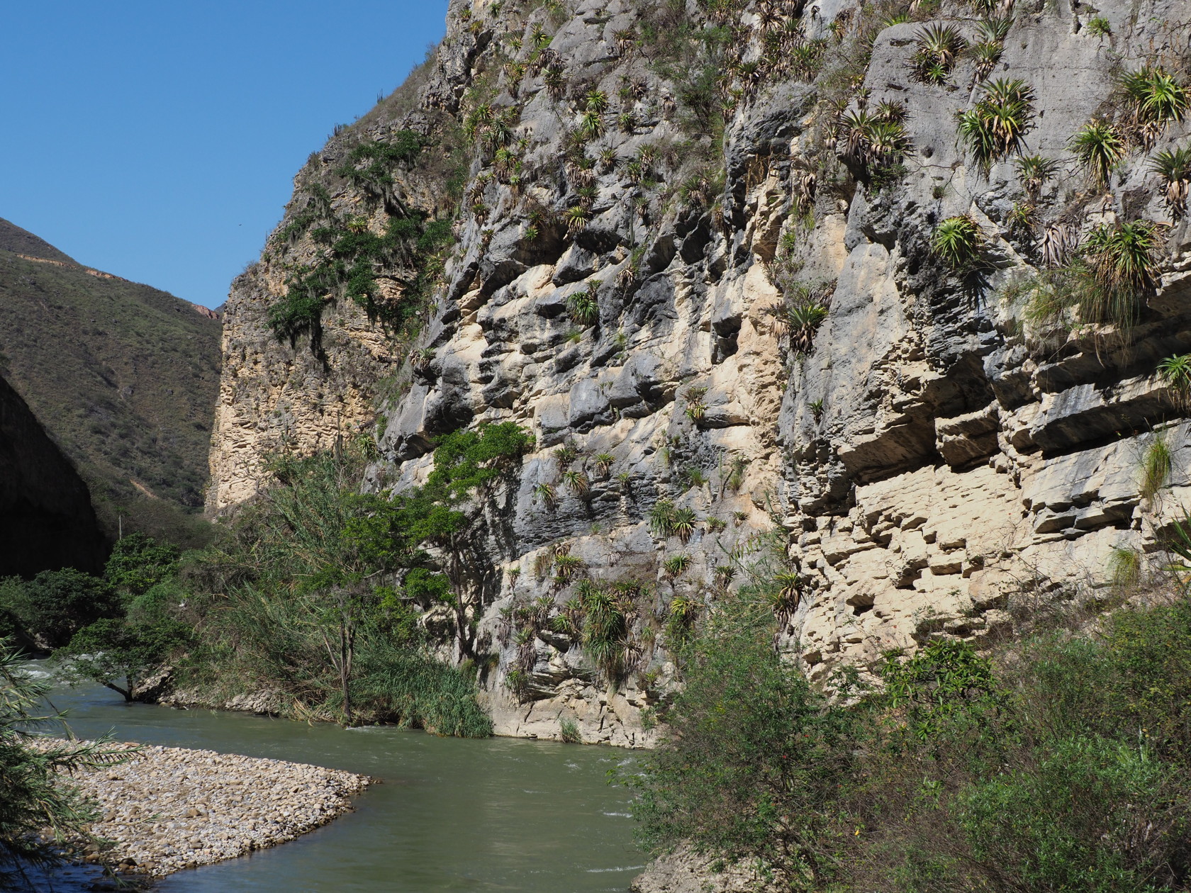
After leaving Chachapoyas, where we had spent the night, the road paralleled the Utcubamba River (utcu=cotton, bamba = flooded grassy plain). This canyon was scenic and had much potential for botanizing – but it was very difficult to access, since stopping spots were few in the most interesting areas. Spotting large bromeliads on the canyon walls, we found a good pull-off to investigate. Despite the usual constraints of steep road-cuts, our pull-off gave us access to the river itself and to many plants. We spent some time admiring the beautiful river-polished rocks and in searching the rock walls for plants. This canyon was the only place where we saw a native palm and where the epiphytic cactus Rhipsalis baccifera was evident.
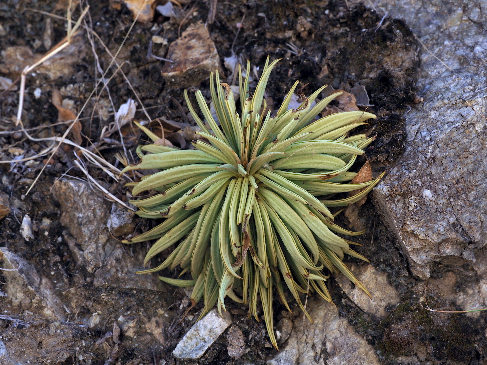
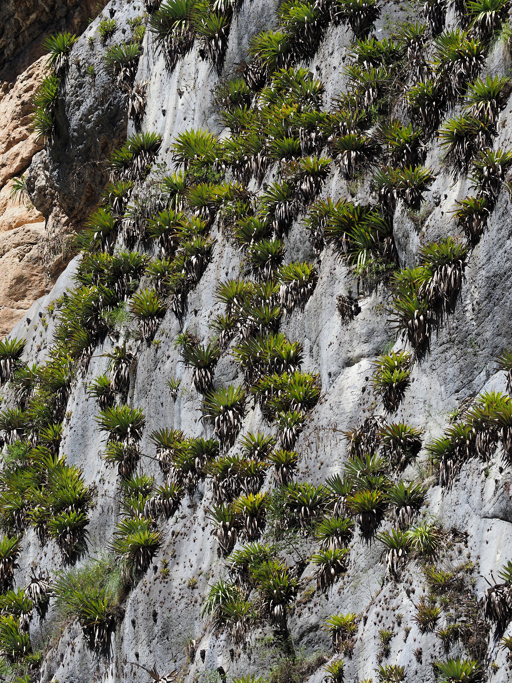
64 The Utcubamba River viewed from a small bridge over it. The rock walls are limestone. Altitude at this stop was about 5600 ft (~1700 m).65 Large bromeliads (Tillandsia carnosa) on a nearly vertical rock wall of limestone.66 Inflorescence of the Tillandsia carnosa – growing on a rock wall.67 A typical roadside situation – how do we get up there?68 Tillandsia carnosa clinging to a nearly vertical rock wall.69 A telephoto shot of Rhipsalis baccifera (an epiphytic cactus) on a tree in the Utcubamba River canyon. It was on the other side of the river…70 Flash photo of a colorful Peperomia aff. lanuginosa.71 A closer iphone image of Peperomia aff. lanuginosa.72 A interesting backlit view of the leaves of a Peperomia dolabriformis var. confertifolia.73 A large Peperomia with inflorescence. Aside from collecting some Peperomias for voucher specimens for permanent collections in Lima and identification by Peperomia expert Guillermo Pino (Lima) we did not collect any plants.74 A Peperomia ferreyrae that we collected.
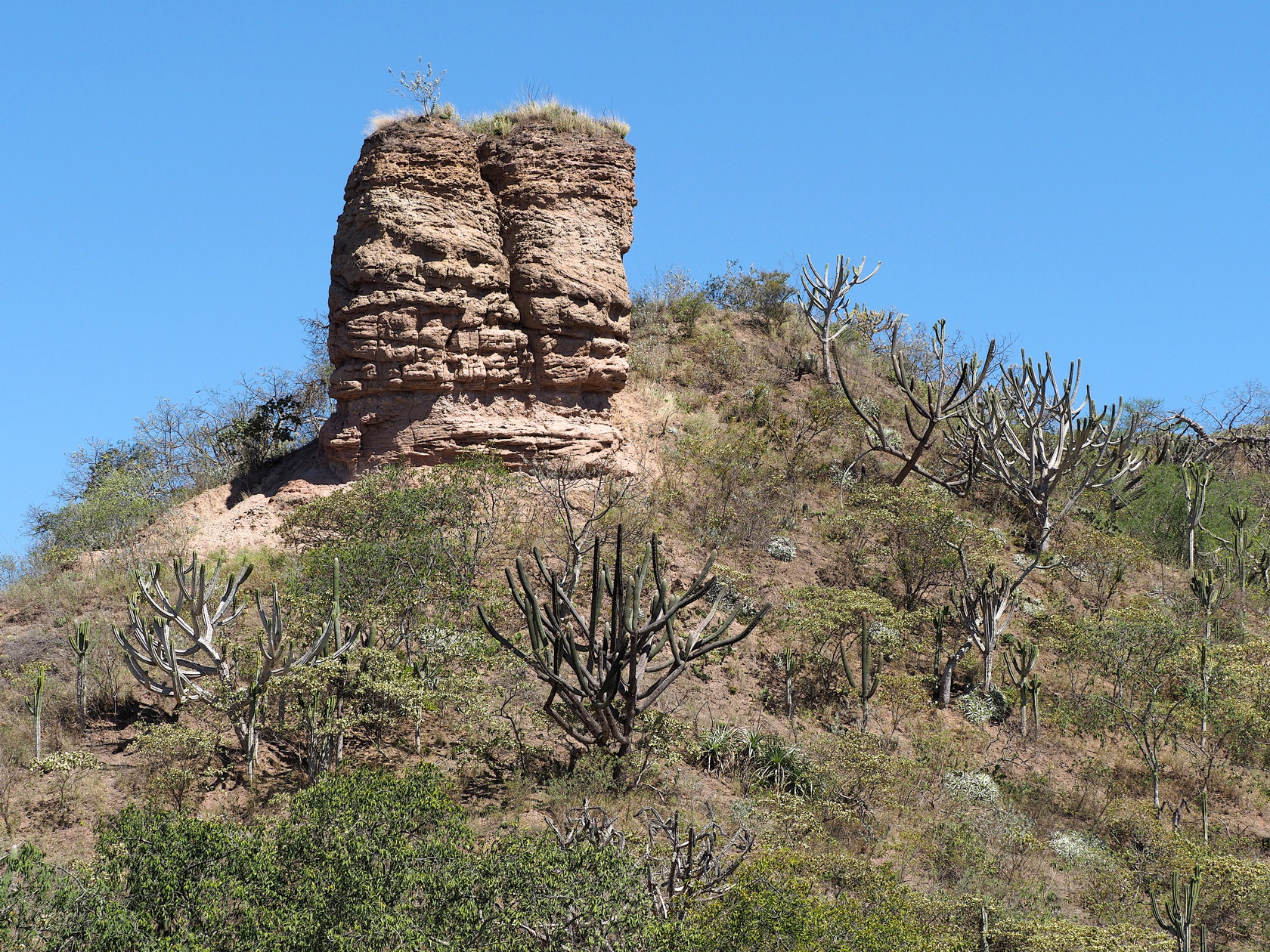
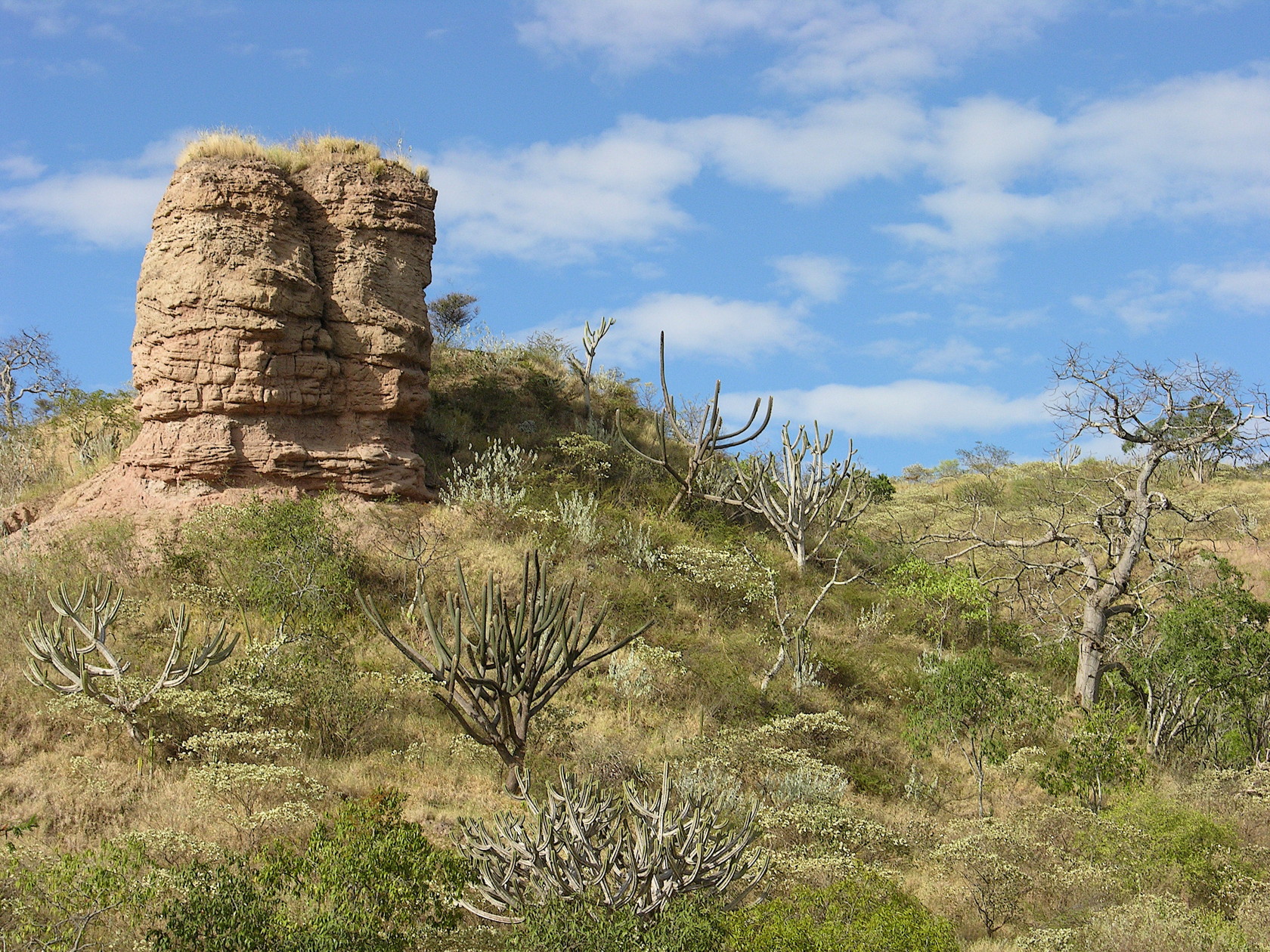
The remaining road from Chachapoyas to Jaen was not particularly interesting until we reached a dry area. Suddenly I recognized a small butte that I had taken pictures of many years ago (2006) when we had visited Jaen and the Bagua Chica area from Piura. I would not have recognized the small butte had it not been one of the photos I’d selected for a screen saver collection on one of our computers! I thought it would be good to explore this area and take photos for comparison with the earlier photos – to see any changes in the cacti that might be evident.
75 A 2019 photo of the “butte” I remembered from our visit in 2006. The most obvious cactus species is Browningia altissima and a large Espostoa lanata in the center.76 Our photo from 2006… Not exactly the same composition or direction of view but the main plants can still be identified. The large Browningia immersed in the shrub at the very front of the photo has now died. Smaller cacti to the right of the Espostoa (near center) have grown.
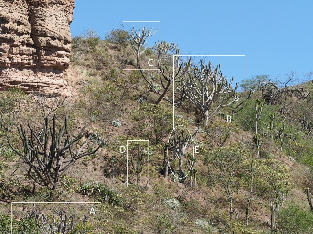
An easier comparison of the growth of certain cacti between 2006 and 2019 can be seen in the two following images. These have boxes and an ellipse that show the same cacti in the different years. Most have clearly grown, but one has died. Repeat photography is potentially a very valuable tool to estimate growth rates of many plants, but it requires a very long-term commitment and precise techniques.
2006 image letters identify the same plants as in the 2019 image2019 image
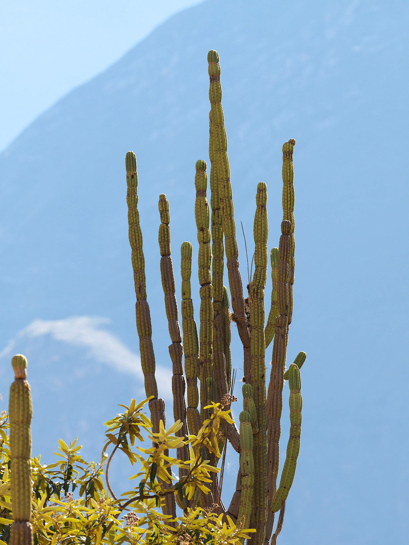
77 Comparison of 2006 image (left) and 2019 image on right. Click for larger images.
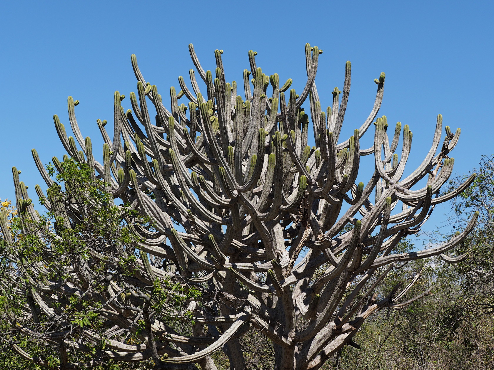
78 Browningia altissima79 Browningia altissima – note smooth trunk lower down.80 A large Browningia altissima
Later, after a snack at the small road junction of Corral Quemado (at the bridge over the Rio Marañon) we headed upstream to see landscapes at the lower reaches of the Rio Marañon. We eventually went to just beyond a small hamlet of Carrizales (on the road to Loyna Grande) before turning around. Although cacti were evident on the hills along our route, the immediate vicinity of the road was disturbed by agriculture or habitations, and there were no convenient stops along this 50 km stretch. Most of the road was not paved and the sides were very dusty. After meeting with some of Manolo’s friends he had stayed with years earlier during his work in this area, we eventually turned around near sunset and returned in darkness to Jaen. Maria did obtain some good video from the drone flights over this area near sunset – fortunately the large numbers of Black Vultures soaring overhead did not attack the drone!
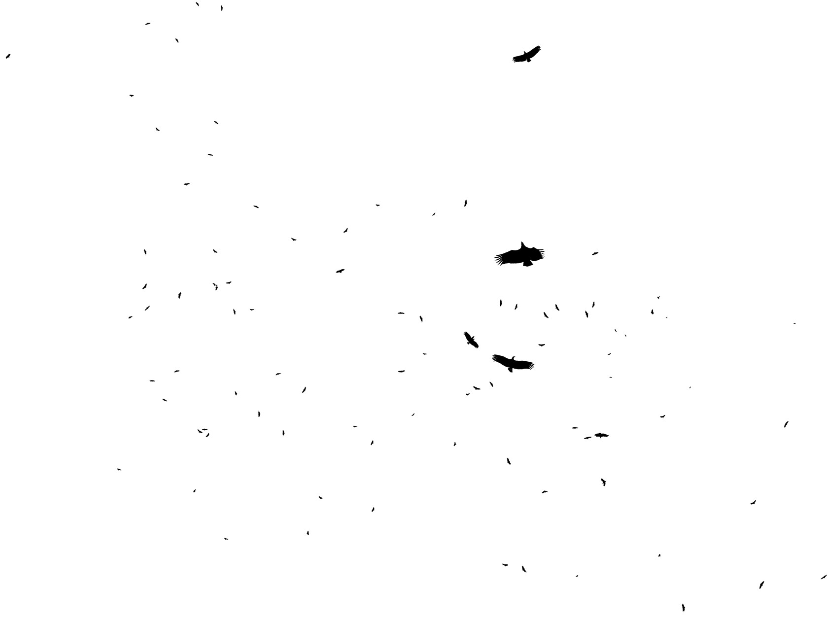
81 Silhouette version of an image of Black Vultures (Coragyps atratus) overhead at our last drone flight location near Carrizales.
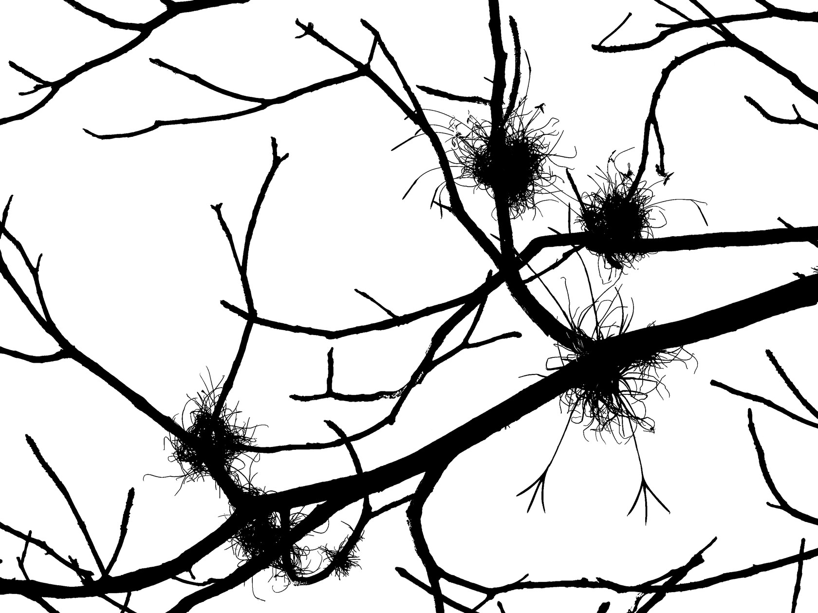
82 Tillandsia recurvata festooning a tree in the lower Marañon River valley. Of course, one does not need to travel to Peru to take such a photo – this Tillandsia has perhaps the largest range of any and is found even in Texas!83 A closer view of Tillandsia recurvata (silhouettes) near Carrizales.
Day 5
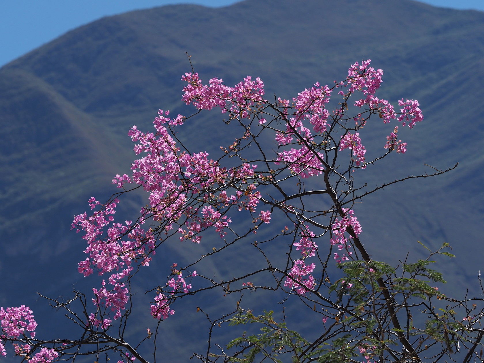
Manolo and Maria left early by bus for a workshop in Piura so we had the morning alone with the driver and his sons and cousin. Because our return flight was later in the day we decided to explore some of the cactus country around Jaen that we were aware of but could not see the previous day. This turned out to be the most productive from the perspective of photography, in large part because the cacti were close to Jaen and accessible to the paved road we were on for the most part. This was in contrast to much of the previous day’s travel where the terrain was steep and road-cuts high, making access difficult in many places.
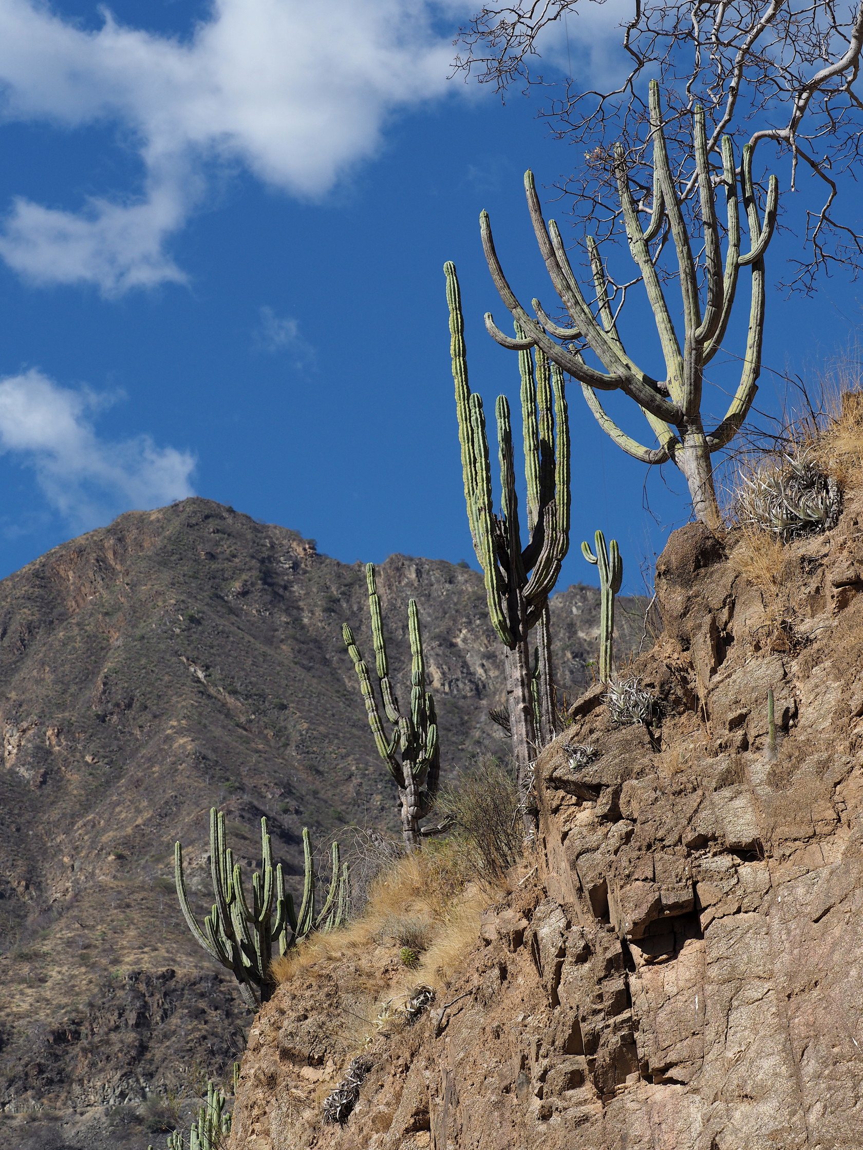
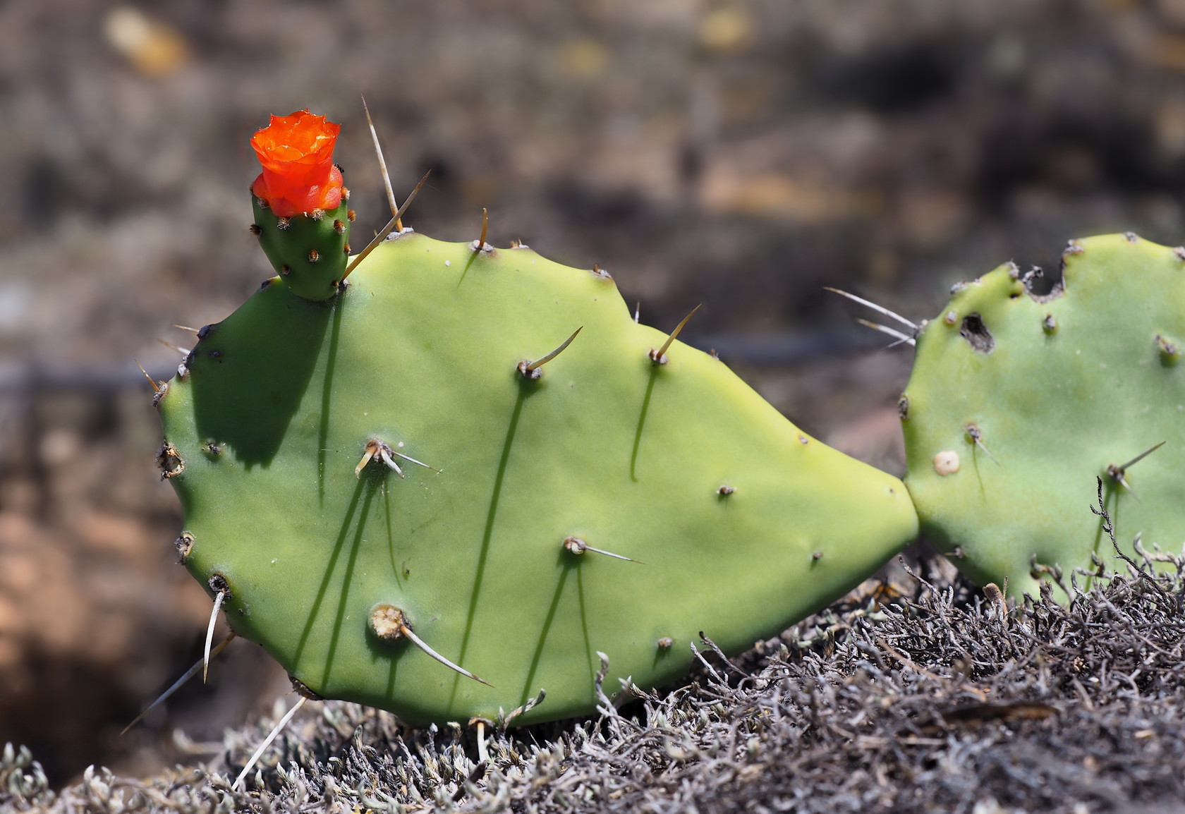
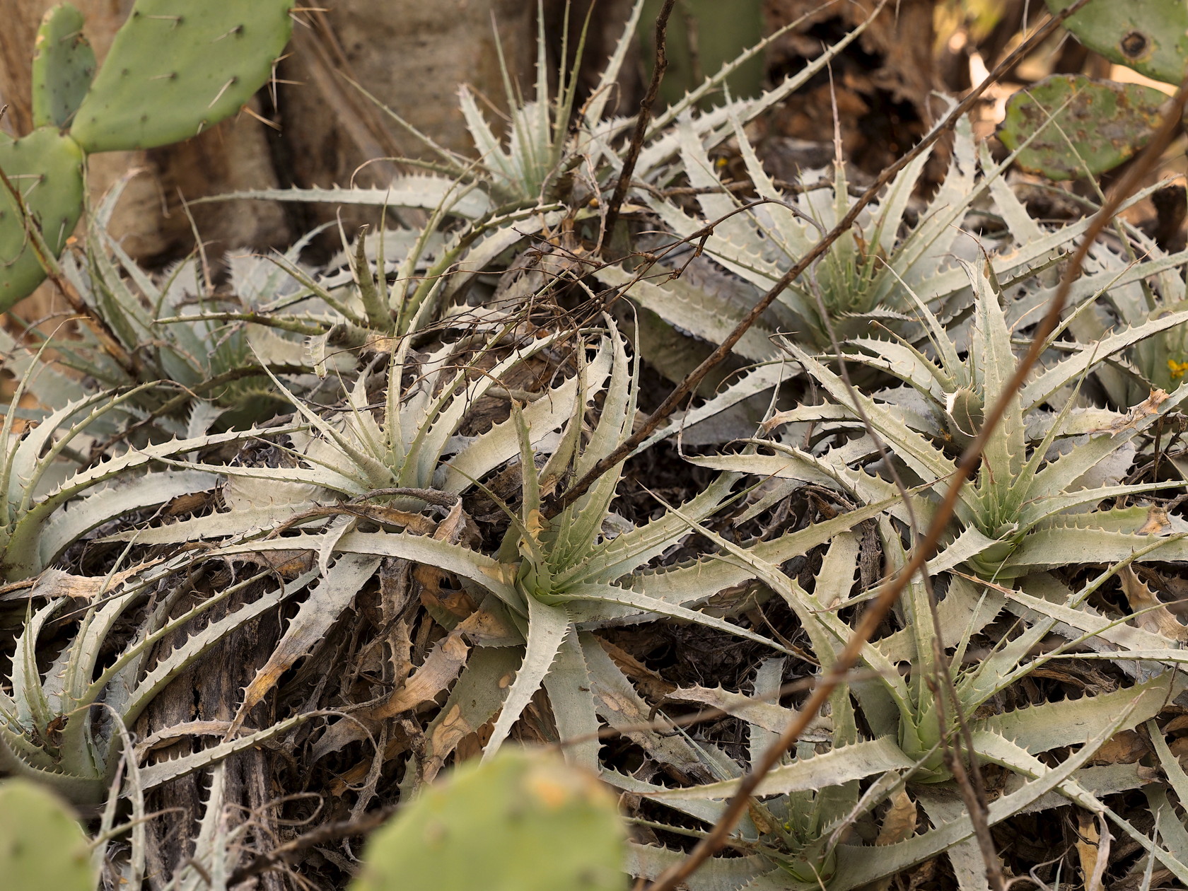
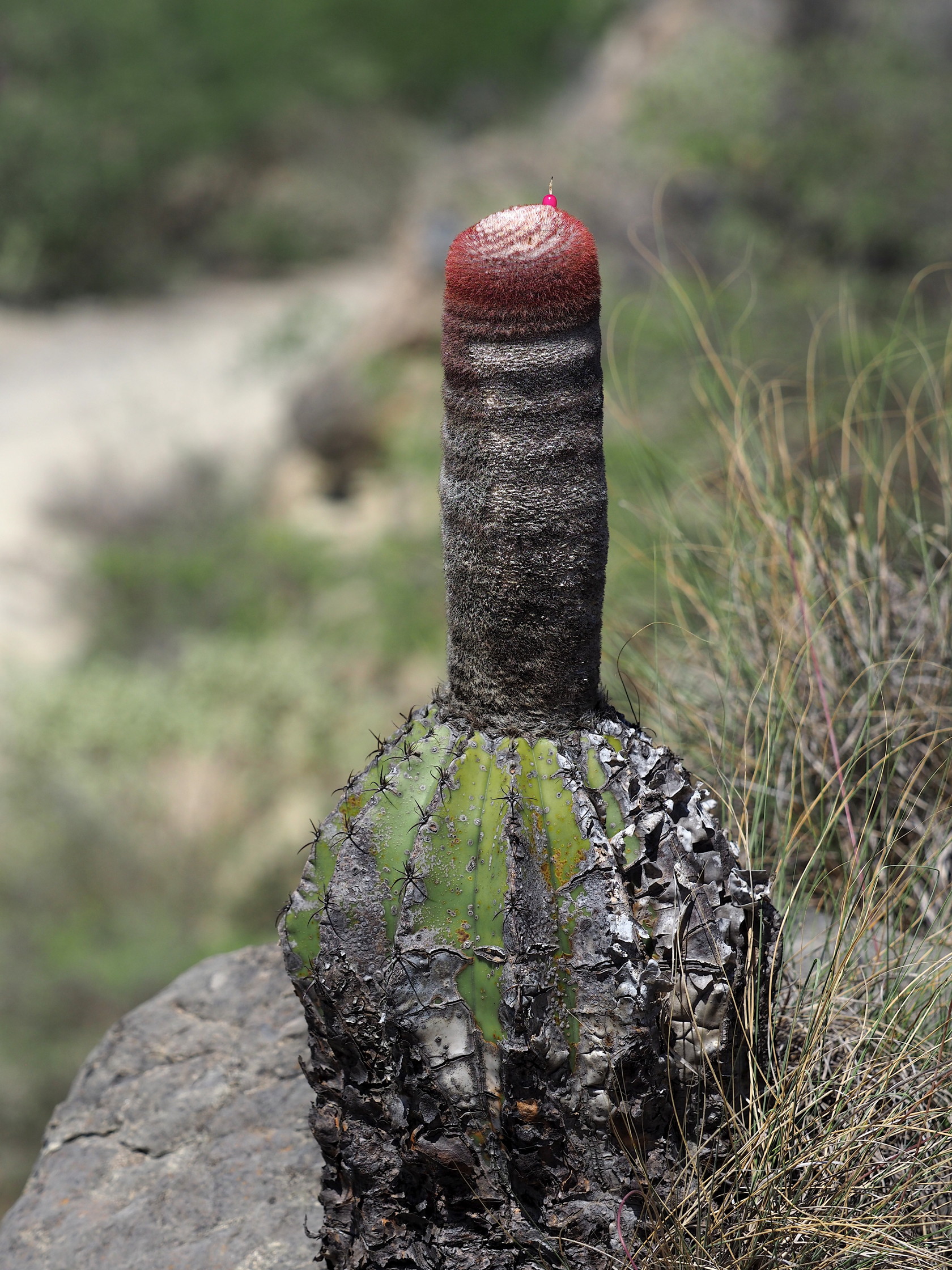
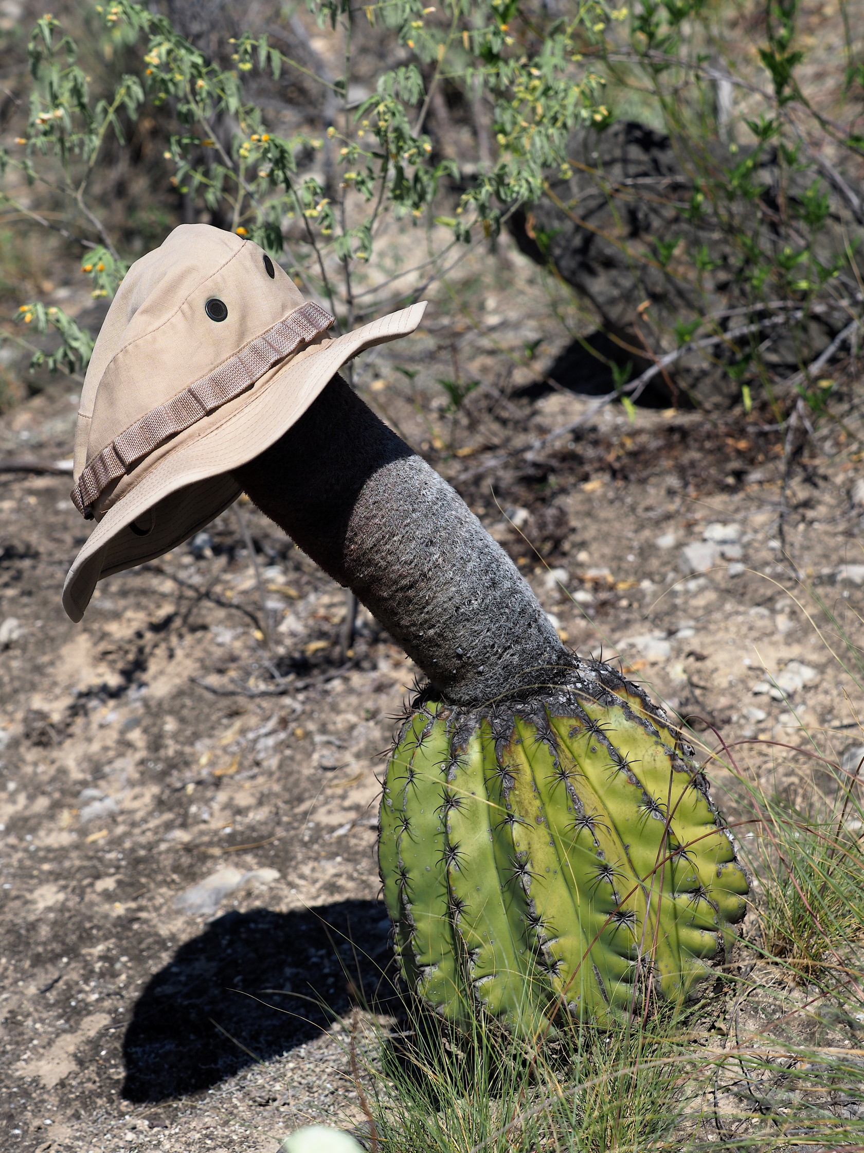
84 View of the Rio Marañon and canyon slopes near Jaén. Road in foreground.85 Hillside covered with Espostoa near Jaén. Such terrain is difficult to walk through due to the numerous spiny/thorny plants.86 Browningia altissima with Rio Marañon river valley in background87 Espostoa blossfeldiorum near Jaén. This cactus doesn’t branch, but does form clusters of stems at the ground level. The cephalia extend quite far down the stems.88 Espostoa blossfeldiorum stems89 Closer view of Espostoa blossfeldiorum and its cephalium90 Browningia altissima near Jaén.91 Hillside dominated by Browningia altissima and smaller Espostoa.92 An Opuntia macbridei patch near Jaén.93 An Opuntia macbridei pad showing its normal bright red flower with small petals. This is very unlike most Opuntia species that have showy yellow flowers with large petals. This cactus was widespread in the dry forest near Jaén.94 Bromeliads (Deuterocohnia longipetala) were abundant in the “understory” of the Browningia and thorny shrubs and these, along with the Opuntia macbridei, made for difficult walking.95 Melocactus bellavistensis with relatively short cephalia – near Jaén.96 Bridge over the Rio Marañon near Jaén. This was where we saw the Melocactus with the largest cephalia.97 Melocactus bellavistensis with long cephalium. The plant itself is rather beat-up.98 A bromeliad (Tillandsia hildae) that we saw only here near the bridge over the Rio Marañon99 Hat added for scale on the Melocactus bellavistensis100 A native Bougainvillea near Jaén. Note that the flower is small and white, the bracts are pink.
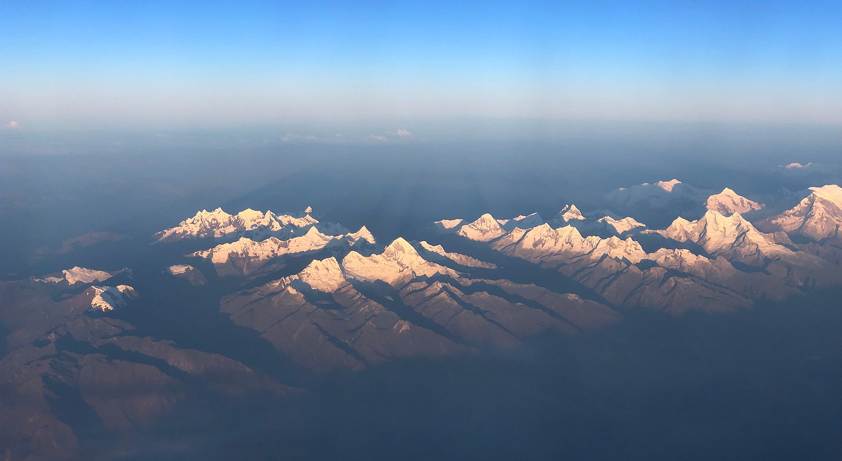
Our return flight had cloud-free conditions and we were able to obtain excellent views of the Cordillera Blanca east of Huaraz, before descending into the darkness and cloud cover of Lima.
101 View of the Cordillera Blanca late in the afternoon, during the flight back to Lima.
Acknowledgments: We would like to thank Guillermo Pino for his identification of the Peperomia and various other plants depicted on this webpage, and also Manolo Fernández for not only his arranging the many details of the travel but help in identification of many plants along the way. Manolo and Reynaldo Linares (Smithsonian Conservation Biology Institute, Lima) identified the main dry forest tree (Eriotheca) in the lower parts of the Rio Marañon shown in various images. Guillermo Rivera of Plant Expeditions identified the bromeliads Tillandsia macbrideana var. longifolia, Tillandsia hildae, and Deuterocohnia longipetala shown here. Denis Cathcart suggested the ID for Tillandsia carnosa. Of course, the driver Marco Huaccha and his sons and cousin all were very helpful throughout the trip. Everyone else is also thanked for their participation including Maria Isabel Rodriguez and also the Cajamarca teachers – Nelson Cieza and his wife.
All photos shown here were taken by either Mike or Rosario Douglas. They have usually been reduced to 1680 pixels across for faster loading times.